Looking up at the head of a palm tree silhouetted against the sky, blue with a thin layer of clouds. A bright white ring, tinged slightly reddish on the inner edge, fills the frame, off-center from the three, the lower left quadrant roughly aligned with the ends of the fronds.

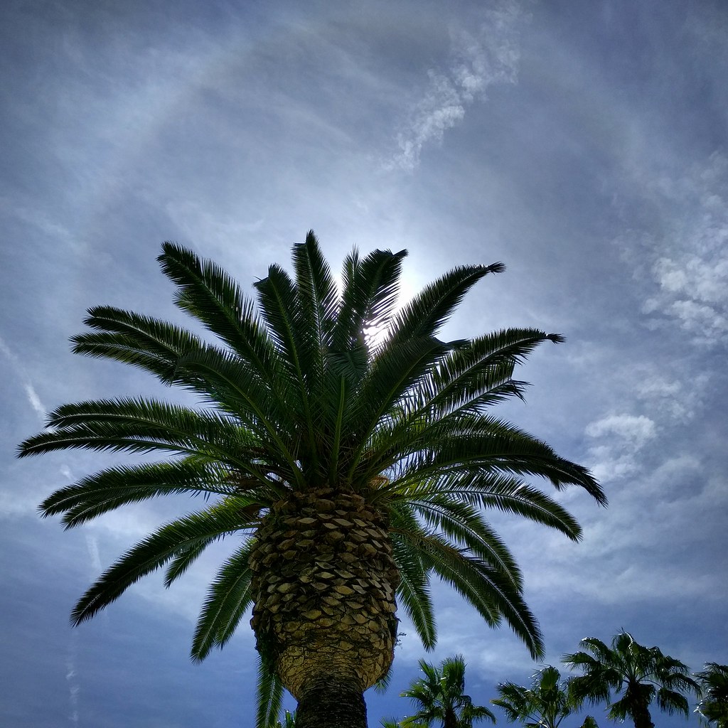
Have you ever seen a ring around the sun? Or a pair of bright spots flanking it? Or a rainbow-colored cloud? Just as sunlight reflecting and refracting inside raindrops can create a rainbow, sunlight reflecting off of ice crystals can form fascinating and beautiful halos. It doesn’t even have to be cold at ground level: if the ice crystals are high up in the atmosphere, spread in a thin layer of cirrus cloud, you can still see them… even in places known for warm weather like Los Angeles. I have a whole gallery of halo photos I’ve taken in southern California. (Edit: Most of them here on this blog too!) You’ll see them more often than you expect. You just have to look up.

Photo Challenge (WordPress): Look Up

Close-up: looking between bars of a metal fence. 2 bars are locked together with a combination lock. Behind the gate we can see a blurry path uphill and scraggly bushes, with another fence at the top of the path.

Behind this gate, a path leads up a narrow access way to a railroad bridge.  Clearly people do get in there from time to time based on the trash – or maybe they just throw it over the fence from the sidewalk. Once I saw two people up on the bridge doing a photo shoot. They probably didn’t get there through here — a block south, there’s an at-grade crossing without any gates, and anyone could easily walk along next to the tracks as long as they keep alert for trains.

It got me thinking about how some boundaries are there to block access, and some are there purely for organizational purposes — consider the property line between two neighbors, defining responsibility for upkeep on each side — and while some of the obstacles we put up are intended to keep people out, sometimes they’re only meant to slow people down or send them down another path.

And then there are the boundaries like the tracks themselves: Structures that aren’t intended to separate regions, but nonetheless just by existing define a near and a far side. Railroads, highways, even natural features like rivers and mountains split communities, climate zones, ecosystems, and nations.

But people are also good at getting past obstacles. We build bridges and tunnels. We find places to ford streams. We find mountain passes, and blast them out to make them easier to cross.

And sometimes? We just go around.

Photo challenge (WordPress): Boundaries

It's gloomy. The sky and sea are almost the same shade of gray. Looking along a steep cliffside toward a rock outcropping. It's high, maybe ten times as high as the low building perched on top of it, and grooves show dozens of layers stacked from the sea below to a bit below the top.

The Palos Verdes peninsula sits at the southwest corner of Los Angeles. Parts of it are built up in old, grid-style suburbs. Other parts are of the more modern, winding type. And still other parts remain open space, due in part to the unstable geology of the area. Parts of Portuguese Bend are sliding toward the ocean, requiring frequent repairs of the main road along the coast. Way back in 1929, a housing development began sliding into the ocean. Abandoned now, the area remaining above land is known as the sunken city.

Adjacent to those ruins is Point Fermin Park, an ordinary city park that sits atop the cliffs. The Point Fermin Lighthouse (previously featured here) looks over the sea, and a fenced walkway runs along the length of the cliffs.

Looking out here, you can see the layers of rock, and understand how parts of the point could just slide away. The warning signs on the fence don’t surprise me, but I have to wonder just who would want to climb out there.

Photo challenge (WordPress): Layers

It's a cloudy day. Behind a white picket fence and green lawn, there's a whitewashed, gabled housel Most of it is two stories, but a square tower in the middle rises two more levels, and the tower is topped with a railing above which which you can just glimpse the top of a glass structure.

Point Fermin Lighthouse in San Pedro, California, at the southern tip of Los Angeles.

The Victorian lighthouse is surrounded by a city park, and the park is lined with a walkway along the top of the cliffs by the sea. Off to one end is the infamous sunken city, a suburban development that was abandoned when the land started sliding into the ocean. I took a whole slew of photos as I walked along the clifftop, and you can see the seven best on Flickr.

This is one of three lighthouses in the area that I considered driving to over the weekend for Instagram’s weekend hashtag project (theme: lighthouses), figuring it had the best chance of clear weather. No such luck. (Update: I have since been to Point Vicente many times, but I can’t remember what the third one was. Maybe the one in Long Beach by the aquarium?)

Strangely, the phone picture I chose for the project turned out to be more striking than the better shot taken with my camera. I was trying to keep the lamppost separate from the house, but it turned out I shouldn’t have.

I’m always surprised when that happens, even though it’s not that uncommon an occurrence.

The same house, but this time it's sepia-toned and fading darker toward the corners. It fills a a square frame with a border that makes it look like the holder in a really old photo album. And the angle is just different enough to make it look fuller, or bulging, or perhaps even looming above the viewer.

Photo Challenge (Instagram): Lighthouse