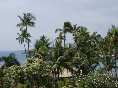
It’s taking me longer than I thought to post all these Hawaii photos. North of Kona there are miles of old lava flows, the most recent of which were in 1801 (from Hualalai, the volcano above Kailua) and 1859 (from Mauna Loa, the second-higest peak on the island). Because the island is right in the middle of the trade winds, and has sizable mountains in the middle, the clouds all bunch up on the eastern side of the island, dropping several hundred inches of rain a year before stopping—rather abruptly—halfway across the island. The west side of the island, especially in North Kona and Kohala, gets closer to 10 inches of rain a year. That’s not far off, climate-wise, from Southern California. It also means that there’s not enough plants to break up a lava field in only 200 years, and large chunks of the coast look like this:

A‘a lava flow in Kohala (with coral graffiti!)
That’s not dirt, that’s rock! You may be wondering about the white bits. They’re a sort of temporary graffiti. All through this area, people have dragged out bits of coral to spell out messages ranging from “Hi Mom” and “Aloha Dolly” to “In Memory Of…” For some reason it’s almost universally good-natured. Katie’s got some interesting pictures. that we’ll be posting later.

Here’s a view of the coast itself. Continue reading

Nene XingThe Nene (roughly nay-nay), a.k.a. the Hawaiian Goose, is Hawaii’s state bird. It’s also endangered. There’s supposed to be a (comparatively) large population in Hawai‘i Volcanoes National Park, but we didn’t see a single one all week. All we saw were a zillion of these signs warning us to avoid hitting them. Maybe it was the wrong time of year, the wrong time of day, or they’re all hiding away from the road.

They warn you not to feed the Nenes either. The concern is that it will encourage them to hang out near roads where they’re more likely to be killed. This reminds me of another bird we did see a lot of. Whatever it was, they were either very stupid or very confident in drivers’ abilities to avoid them, because they would just amble across the road, pausing occasionally, making no effort to dodge the cars zooming at them at 35, 45, or 55 MPH. It was several days before we saw one actually bother to fly a few feet!

When we visited Oahu two years ago, we noticed that aloha was everywhere, and meant everything. Aside from hello and goodbye, it seemed to represent an easy-going, positive attitude. There were signs all over the place saying things like “Drive with aloha.”

Then there was mahalo, Hawaiian for “thank you,” which is used everywhere in place of the English phrase. Either it’s part of the wave of Hawaiian identity, or it’s mandated by the Hawaii tourist board.

Aloha is all over the big island as well, but not quite to the same extent. We didn’t see a single “drive with aloha” sign this time around, for instance.

What we did see was kapu. Kapu is the Hawaiian form of taboo, a word which has lost much of its meaning both in modern English usage and in modern Hawaiian usage. In traditional polynesian cultures, a taboo was a sacred prohibition, and violation was often punishable by death (generally by way of being chosen for a human sacrifice). These days, kapu mainly shows up on “No Tresspassing” signs—of which there are plenty!

When we got back from vacation, I had nearly 2 MB of spam waiting. That’s after all the spam filtered out by blacklists, SpamAssassin, etc.

I should’ve left it in Hawaii. They like it there.

(Actually, they like SPAM—I seriously doubt they like spam any more than the rest of us.)

We spent a lot of time exploring the Kona coast, where towns manage to be both beach towns and mountain towns at the same time. It’s simplest to think of the island as one huge mountain (though there are really four mountains on the island, with a fifth, Kilauea, working its way up). The land just climbs up out of the sea and it’s easy to get several thousand feet up without going very far inland.

On our first full day, we just headed south to see what we could find. We randomly turned down Napo‘opo‘o Road, which while acceptable by rental-car standards, was a very winding road with lots of drop-offs. The road leads to Kealakekua Bay, a major kayak launching point, where we stopped and got a view across the bay.

View across Kealakekua Bay

This shot quickly became my new desktop background on the laptop. Way off to the left (not visible in this photo) is the obelisk marking the spot where Captain Cook was killed by Hawaiians in 1779. Right by the road are the remains of the Hikiau Heiau (a heiau is a Hawaiian temple), where Cook read the burial rites for one of his sailors. Continue reading