It’s taking me longer than I thought to post all these Hawaii photos. North of Kona there are miles of old lava flows, the most recent of which were in 1801 (from Hualalai, the volcano above Kailua) and 1859 (from Mauna Loa, the second-higest peak on the island). Because the island is right in the middle of the trade winds, and has sizable mountains in the middle, the clouds all bunch up on the eastern side of the island, dropping several hundred inches of rain a year before stopping—rather abruptly—halfway across the island. The west side of the island, especially in North Kona and Kohala, gets closer to 10 inches of rain a year. That’s not far off, climate-wise, from Southern California. It also means that there’s not enough plants to break up a lava field in only 200 years, and large chunks of the coast look like this:
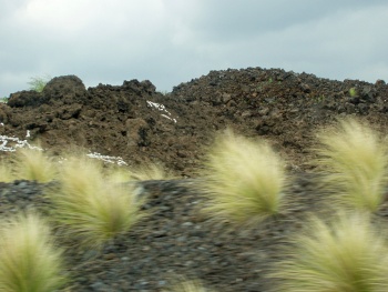
That’s not dirt, that’s rock! You may be wondering about the white bits. They’re a sort of temporary graffiti. All through this area, people have dragged out bits of coral to spell out messages ranging from “Hi Mom” and “Aloha Dolly” to “In Memory Of…” For some reason it’s almost universally good-natured. Katie’s got some interesting pictures. that we’ll be posting later.
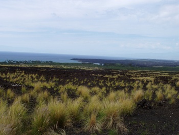
Here’s a view of the coast itself. Our guide on the Mauna Kea tour told us what was in that stand of palms, but I can’t remember:
(This is also the area where you’ll see the Donkey Crossing signs.)
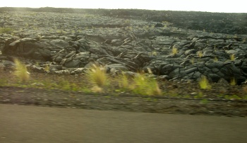
Here’s another picture that shows a pahoehoe flow (a‘a comes out cooler and chunkier, leaving behind jagged rocks, while pahoehoe is hotter and more liquid, so it flows smoothly and often cools with ripples still visible).
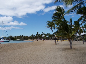
Because of the rain shadow, this side of the island gets a lot more sun, so people have been building resorts along the coast. One of the biggest, Waikoloa, has its own shopping center with its own Macy’s. It was also where our catamaran cruise launched, so we visited their beach. This is probably more what you were expecting from Hawaii:
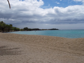
It was very windy that day. Mauna Kea and Mauna Loa are roughly straight north-south from each other, so the trade winds just go up and over the saddle in between and hit, well, Waikoloa. And with so few trees in the lava flows, there’s not much to slow them down.
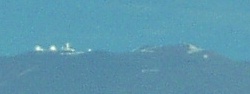
We were very familiar with this stretch of road by the end of the week. Our first trip along it also brought us our first view (from the ground, anyway) of Mauna Kea:
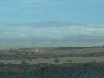
You can actually see some of the observatories up on the peak:
Continuing north you come to the Kohala peninsula and mountain. The oldest of the island’s volcanoes, depending on who you talk to it’s either extinct or very, very dormant. (It’s been thousands of years.) It’s the only area we saw that showed more signs of erosion than vulcanism. Like the island as a whole, it has a wet side and a dry side. The highway runs up along the west side of the ridge to the tip, then along the west coast back to the main part of the island. A lot of the land is current or former ranch land, and you see cows all over the place. The east side doesn’t have a highway, and as near as we can tell is mostly undeveloped. The closest we got was the lookout above Waipio Valley on the east coast. (I’ll also explain why we didn’t get any closer than the lookout!)
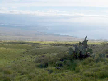
These next few pictures are from a turnout up along the ridge of Kohala, looking south toward the coast and the bay.
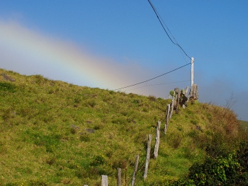
Oh, yes, about that rain shadow? It explains why Hawaii puts rainbows on its license plates. With full-on rain right next to clear skies, rainbows are incredibly common. Here in southern California we hardly ever see rainbows. I don’t think a day passed in Hawaii that we didn’t see one!
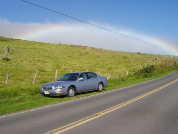
Oh, yeah, rental car trivia: Because Hertz was backed up so badly (Four flights arrived at once, and even spread across several rental agencies, it kept us in line for about an hour), they handed us the first car they had available instead of waiting to get the economy car I’d reserved. They gave us a Buick LeSabre. While it has a lot of nice features, it tries too hard to be a “smart” car. If it can be done automatically, it’ll do it. Light sensors trigger the headlights, moisture sensors trigger the windshield wipers, the air conditioning and heater are handled thermostat-style. If you want to do things on your own terms, you can’t. Definitely not the right car for a Linux user.
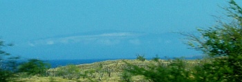
One last photo for today. Our first time up this coast we noticed some rather sharply defined dark cloud banks, one out to sea and one across the bay. As we drove north, one of them resolved into the mountain of Kohala, which left us wondering whether the other one might be the next island over. It turns out that yes, you can see Maui from here. Between clouds and haze we never got a clear view, but we at least managed to get a better view than that first day:
Note: Most of these photos were taken on Wednesday, April 6, 2005. A few were earlier or later in that week.
Update: I’ve posted higher-res photos on Flickr.


Good stuff! We were at the Waikoloa Marriott, so we saw that beach out our window. And we didn’t have a line at Hertz, but they upgraded us to a Mustang convertible anyway. Sweet! Oh, and thanks for the answer about those donkey signs.