A fire is raging in the hills and canyons of Orange County. It’s nothing compared to the devastation in Northern California, where 160,000 acres have burned, killing 21 people and wiping out whole neighborhoods in Napa and Santa Rosa — but a dozen homes have been lost and about as many damaged in the 8,000-acre blaze near Anaheim.

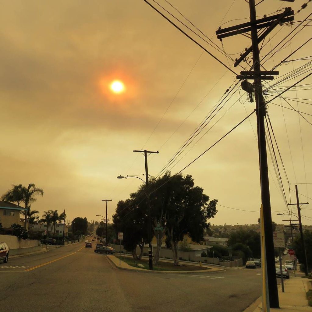
Even though I live farther away now, the smoke still reached the coast on Monday, the first day of Canyon Fire 2 (so-named because it picked up where the Canyon Fire left off last month). It turned the sun orange and the sunlight yellow, like sunset but at too high an angle. The smoke is a lot more diffuse now, looking more like typical smog, and firefighters are getting the fire under control as the weather changes.

The evacuation maps and the photos of Peters Canyon remind me of the Santiago Fire ten years ago this month. That fire burned for nearly three weeks and scorched 28,000 acres. I wondered whether they ever caught the arsonist who set it. As far as I can tell from a quick search, they never did. The most recent article I found was on the five year anniversary of the fire. At that time, they had “narrowed the search to three suspects…but no arrests [had] been made.”

October is always a bad month for wildfires in California. Plants have been drying out all summer, the winter rains haven’t started yet, and the hot, dry seasonal winds of fall — Santa Anas in the south and Diablos in the north — whip up the flames and drive them long distances. But in the last decade, more and more fires have burned large areas in summer, spring, and even winter, to the point where “fire season” may as well be year-round.

The practice of recycling old news articles still throws me off at times. For instance: here are two recent LA Times articles using big disasters as springboards to talk about possible giant earthquake scenarios in California. They start out talking about the Houston flooding from Harvey and yesterday’s quake in Mexico, then segue into Los Angeles disaster planning. By the end, they’ve segued into the same text. I was reading today’s and thinking, “I just read this, recently.” A ten-second search turned up the older article.

It’s not plagiarism. It’s the same reporter at the same newspaper. It’s basically the equivalent of stock footage, and it’s hardly the only example. It’s probably not even a new practice, just a lot easier to find now that everything’s online and searchable.

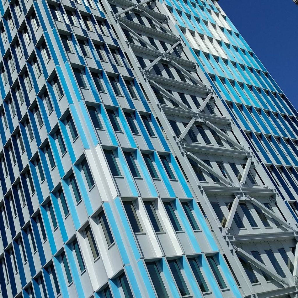
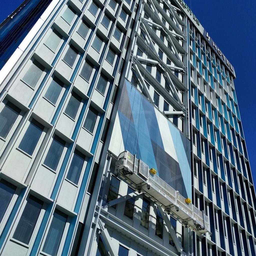
Adding a splash of color to Brutalist design, in the final stages of converting an office building near LAX to a hotel. Believe it or not, the bolted-on cross pieces are new. I can’t imagine they’re aesthetic, which makes me wonder if it’s some sort of earthquake retrofitting and they’re making the best of it.

It’s an interesting approach, but it still looks way more institutional than inviting, IMO.

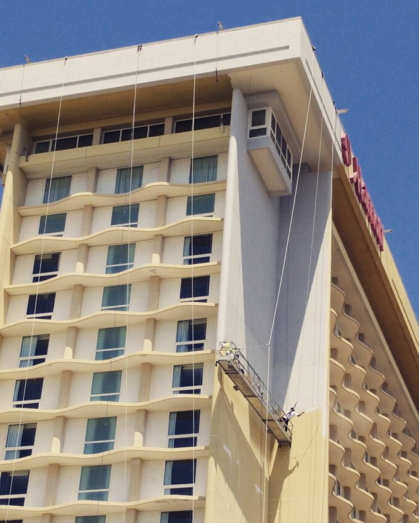
Update: It turns out the scaffolding is being used to hang a full-height geometric design. I’m still not convinced it didn’t start as some sort of seismic retrofit, but it will at least look a little more inviting once they’re done.
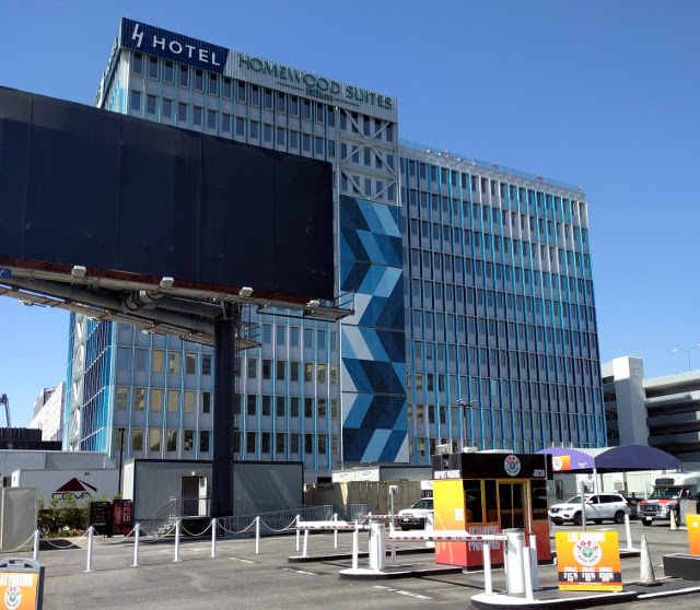
These are all on three different days, incidentally, which is why you can’t see the first square on the left side in the middle photo.
Update: This LA Times article on what to do in an earthquake may be relevant. In most cases, you want to drop, cover, and hold — don’t run outside, since you’re more likely to be hit by something falling off a building than crushed in a collapse. But “brittle concrete buildings” are more likely to collapse than other types.

The city of Los Angeles in 2015 passed a law requiring those buildings to be retrofitted, but gave owners a 25-year deadline to do it once they are given an order to seismically evaluate the building. The city is still working on preparing its list.

Hmmm….

At first I couldn’t see how they kept the platform near the walls, but then I realized the most visible cables weren’t the support. They’re actually slack. They’re probably used to lower the platform over the roof, before it’s hooked up to the less visible cables hanging straight down down from the inner edge of the overhang.

I don’t remember much about Marineland of the Pacific. It was an ocean park/aquarium like Sea World that operated near Los Angeles for several decades, closing in 1987. I know I visited at least once, with my grandparents, but all I remember is:

  1. The view from what I assume was Palos Verdes Drive, as the car crested a low summit, brown hills rising to the right and falling gently toward the ocean on the left. The park stood on a promontory jutting out into the ocean. I haven’t been able to locate the spot, but that could just mean the road’s been moved.*
  2. A sign saying “CAFE” visible from the parking lot, which I misread as rhyming with “safe.” (Evidently I was very young at the time.)
  3. That’s about it.

You’d think I’d remember the sea life at least a little, though I suppose it’s possible I’ve misattributed some memories to Sea World (which, come to think of it, I don’t remember super-well either).

Not much of Marineland remains aside from a few names at Terranea Resort, which now occupies the site. But a piece of that history is coming back. In 2014, a 35-foot whale statue from the park entrance was found in a maintenance yard. The city has approved plans to place the statue at Point Vicente Park just up the road.

Apparently the decline and closure of the park was rather sordid: HBJ, the textbook company that owned Sea World at the time, had tried to buy Marineland’s star orcas. They weren’t selling. So HBJ bought the park in December 1986. Late in January, they secretly loaded Orky and Corky onto trucks in the middle of the night and drove them down to San Diego. A week later, they announced the park would close in March. They shut it down halfway through February, and by May they’d sold off the property to a real estate developer. Plans for a conference center were never realized, and the site was abandoned for 20 years until construction began on Terranea.

*Update: My dad pointed me to the Wikipedia article, which led me to a post at Modern Day Ruins, which led me to the California Coastal Records collection of aerial photographs. I found one from 1986 that indicates that Rancho Palos Verdes Drive is in the same spot as it was back then, but the housing developments on either side to the east of the turnoff weren’t there at the time. That’s probably why I didn’t recognize it. Or the road I remember could be the one down to the parking lot.