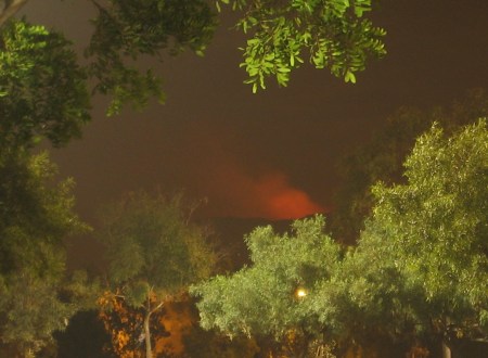
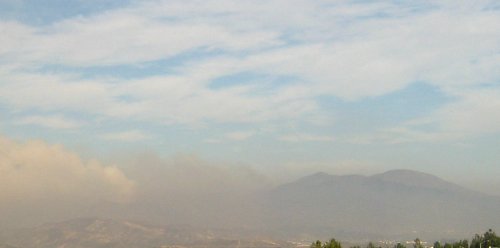
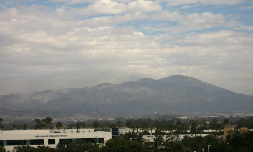
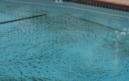
While driving to work this morning, I looked off to the left and saw this beautiful view of fluffy white clouds hugging the mountains, and bright sunlight on the patchy green hills.* When I got into work, I went straight for the corner conference room that has a view in that direction… but the clouds had rolled in and turned everything gray. I kept checking back every so often, but the closest I got was this:

Green patchy hills

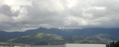
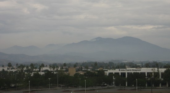
It’s been great to have a more normal amount of rain this year. The coastal hills all turned green after the second rainstorm, early in December. The hills up by the mountains took longer, since most of the area had burned off in the Santiago fire. Faint patches of green started to appear around Christmas, and now, the lower hills at least are more green than brown.

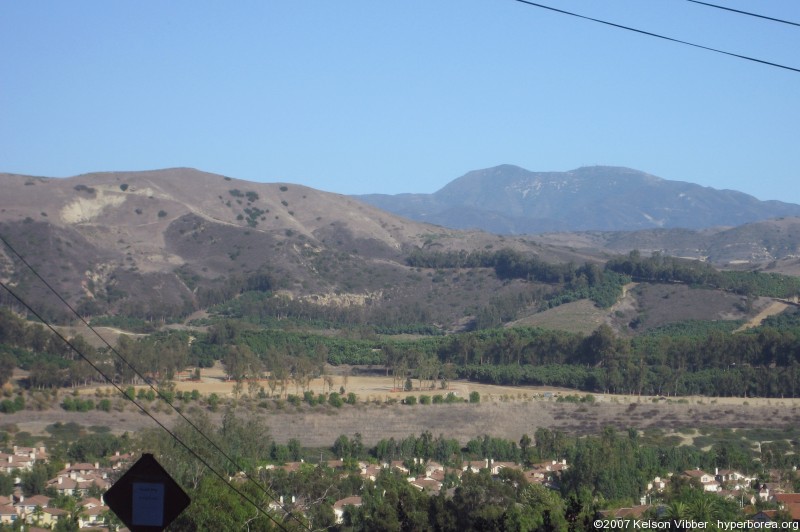
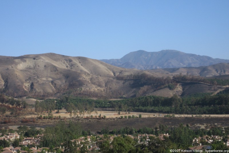
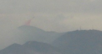
The scenery still looks odd, though. There’s a third peak (Flores?) near Saddleback, about 1,000 feet lower, that normally blends in with the mountain behind it. Well, the entire north face of the hillside burned. Then high winds blew the ashes away. People coated it with a green-gray material that I suspect was intended to prevent mudslides (it looked like the stuff they spray on dirt embankments in construction projects before the landscaping kicks in). It rained, repeatedly. Then we had high winds again, clearing all the gunk out of the air…and now it’s got the light brown color normally seen on the lower, closer hills during the dry season, instead of the darker brown of the mountains. It doesn’t blend at all, even from as far away as Tustin.

Saddleback with a large hill in front of it

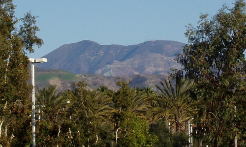
This was taken from in front of the Ralphs on Jamboree on January 13. You can see the line of hills in front is still a green/brown mix, and then there’s this light brown lump rising up behind them. On the left side you can see some remnants of the anti-erosion substance.

The following day, on my way to lunch at the Irvine Spectrum (7 miles away, and perhaps a 30-degree difference in angle), I went over a bridge and saw Saddleback next to the Ferris wheel. I knew I had to get that shot.

I parked in the west parking structure, then went running around the top floor looking for a spot where I could frame the wheel and the mountains together, and avoid too many light poles, and get above the few cars, and not have to worry that losing my balance would cause me to fall 3 stories to my death. I finally climbed onto one of the support pillars for the light poles in the middle of the deck, where if I fell I’d only fall a few feet.

Saddleback and Ferris Wheel

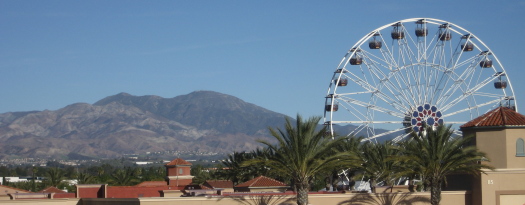
Here, you can really see the difference between the areas that burned and those that didn’t. Compare this to the third picture in Saddleback Snow, or the second in Ashen Mountains.

Sadly, the best places to take photos from seem to be the middles of freeway bridges and tops of private buildings — in other words, inaccessible.

On a clear day in early October, I went driving up into the Tustin Foothills to see what I could see. I took a bunch of photos at a turnout, and also stopped at an intersection that gave me a nice view of Peters Canyon, the hills behind it, and Saddleback in the background. I used this photo a few weeks later for my drought post.

After the Santiago Fire, I waited for another clear day (which took several weeks), and set out to do it again and see just how far north the fire had reached. I managed to get a great pair of before and after photos from the intersection of Foothill and Lemon Heights.

Mt. Saddleback seen from Tustin foothills, October 2007
October 6, 2007. Click for a larger version

Mt. Saddleback seen from Tustin foothills, November 2007
November 24, 2007. Click for a larger version

While the orchards seem to have been spared, you can see the field in the foreground looks scorched, and most of the trees making up firebreaks seem to have died. More dramatic are the hillsides. Before the fire, you can see expansive dark patches of scrub, wide expanses of lighter dried grass, and occasional dark green bushes. Now it’s all dirt, except for the blackened remnants of the bushes. There are several gullies whose sides were hidden and softened by the ground cover, but are now starkly visible. And after this week’s rain, they’re probably eroded even more.

A few notes: The air was somewhat clearer for the “after” photo, and it was earlier in the afternoon, so the angle of the sunlight helped pick out terrain features a bit better.

Things are starting to get back to normal, at least for those of us not directly affected by the Santiago Fire. There was a layer of haze coating the mountains Monday morning, but the air smelled normal, and the sky, when the clouds broke up, was blue.

Layer of smoke in front of backlit Saddleback

My co-worker who stayed behind in Silverado came back to work today, and had all kinds of stories about everything from rescuing kittens from burning houses and repairing a radio repeater to holding off advancing flames with a length of PVC pipe (using it to break apart the brush ahead of it).

The air was clearer even than usual, affording a detailed view of the hills and Santa Ana Mountains. The clouds made patterns of light and dark on the landscape. The hills looked better in sunlight than in shadow, with the light brown (dirt?) dominating over the charred stubble. In the shade, the hillsides simply looked blackened.

The mountains, on the other hand, looked better in shadow. As silhouettes, they looked no different than on any hazy day (except for the one plume of smoke still rising). In sunlight, however, they looked gray (normally from this distance they look brown) from all the ashes. From what I read, there are places where every bit of vegetation for acres has burned. My co-worker said areas of the mountains looked like a moonscape.

Gray mountains covered with ash

I actually saw, from a long distance, a helicopter (presumably) dropping red flame retardant on the mountains to create a fire line.

Red flame retardant dropping into the mountains

Late in the afternoon I actually spotted some faint Anti-crepuscular rays (think Thomas Kinkade, but in the direction opposite the sun) looking out the window. They were too faint to get a decent photo, though.

Sometime, maybe this weekend, I plan on driving out to see the landscape more closely.

Golden Sunset

The change in the weather has brought in clouds today (Saturday), and even the occasional sprinkle of rain. It apparently helped slow the Santiago Fire considerably.

I went into work this morning to deal with some network problems (you may have noticed that this site was down for a while), then went over to the Spectrum to grab lunch and take a look at Leopard. (Incidentally, my plan seems to have failed: Amazon shipped the box yesterday, so I’ll have it in just a few days. And I’ll really want to put it on the PowerBook.) I went up to the top of the parking structure to take a look at what was visible.

Saddleback Smoke and Clouds

There’s considerably less smoke than yesterday, and you can see the beginnings of a layer of haze below the hills. The cloud of smoke peeking out from behind the lower peak just in front of Saddleback stayed there, without getting visibly larger or smaller.

The air’s been relatively clear, except for the fertilizer smell when I walked out of the office. People were out shopping and sitting at outdoor tables. I saw one woman walk by with a face mask, but everyone else seemed to be taking things as normally as possible.

The apartment complex cleaned out the pool, which a few days ago had intricate patterns of ash lining the bottom.

Ashes at the base of a swimming pool

Orange Sawdust
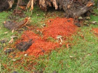
They also finally cleared away the remnants of the tree that collapsed on Sunday. They chopped it up into smaller pieces, and moved it off the sidewalk, but left the stacks of logs, branches, the stump and piles of sawdust sitting on the lawn for the rest of the week. After a day or so, the sawdust turned almost bright orange. My best guess is that they ran the sprinklers.

Of the two co-workers who live out in Silverado, one cleared out on Tuesday, while the other stayed to help out with, well whatever he could. Putting out spot fires, rescuing animals, scouting. His wife has been sending out email updates whenever he manages to contact her. I ran into the one who evacuated at the office today (he frequently comes in on weekends). At the time, the prognosis didn’t look good, but now it sounds like the canyon homes were spared for another day.

It still wasn’t encouraging when, walking to the Corner Bakery at the Tustin Marketplace tonight, Katie and I were again able to see a red glow in the mountains. We went looking for a spot where I could both steady the camera and see the glow, and finally set it up on one of those waist-height light poles lining the entryways to the parking lot.

The glow brightened and dimmed several times while we paused.

Fireglow above the hills, framed by trees

This is a 10-second exposure taken around 8:50 PM. You can see how well-lit the parking lot is by looking at the trees. I suspect the Marketplace is the primary reason we can’t see as many stars from home as I’d like.

Winds have shifted northward. The good news: my workplace is no longer drenched in smoke from the Santiago Fire. I can see blue sky and wispy clouds, terrain back to the nearby hills, and the twin peaks of Saddleback rising above the smoke. Reportedly the northern peak (the one without all the radio transmission towers) has burned, though it’s hard to tell at this distance. The bad news: it’s sending the flames straight at Silverado Canyon, which was spared earlier this week when the fire raced past it eastward. Once again, worried about the co-worker who stayed behind and spent the last few days rescuing animals and relaying information.

Smoke rises from in front of Saddleback