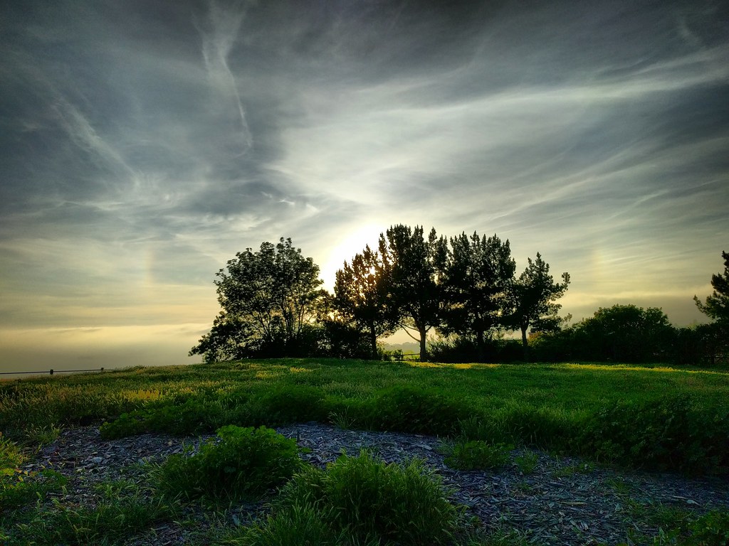
A whole lot of wispy clouds, plus fragments of a glowing circle above a green landscape. A grove of trees is silhouette against the sun.

After an afternoon of ice skating, I talked the family into making a quick trip up to Del Cerro Park in Palos Verdes. It takes a while to get there from home, but since we were already up in the hills for the ice rink, it was about five minutes. My original plan was just to walk out there myself, spend five minutes enjoying the view and taking pictures, then head back, but the five-year-old wanted to come along rather than wait in the car with mom.

Of course kids have their own pace, and while he wasn’t terribly interested in looking out at the ocean from a hilltop a few thousand feet up, he was fascinated by a lot of the other things along the way, which was how we ended up getting close to the hilltop at the right time for this view of the sky, sundogs, cirrus clouds, criss-crossing contrails, and silhouetted trees.

To be honest, he wasn’t terribly interested in that view either. At five, checking out foxtails and giant clover and gopher holes and fragments of concrete slabs (in a suspiciously flat and rectangular depression) and looking for the entrance to an incredibly long stairway and climbing and balancing on logs and looking for “the actual park part of the park” (i.e. the playground) are more appealing, and I barely had a chance for this moment to register.

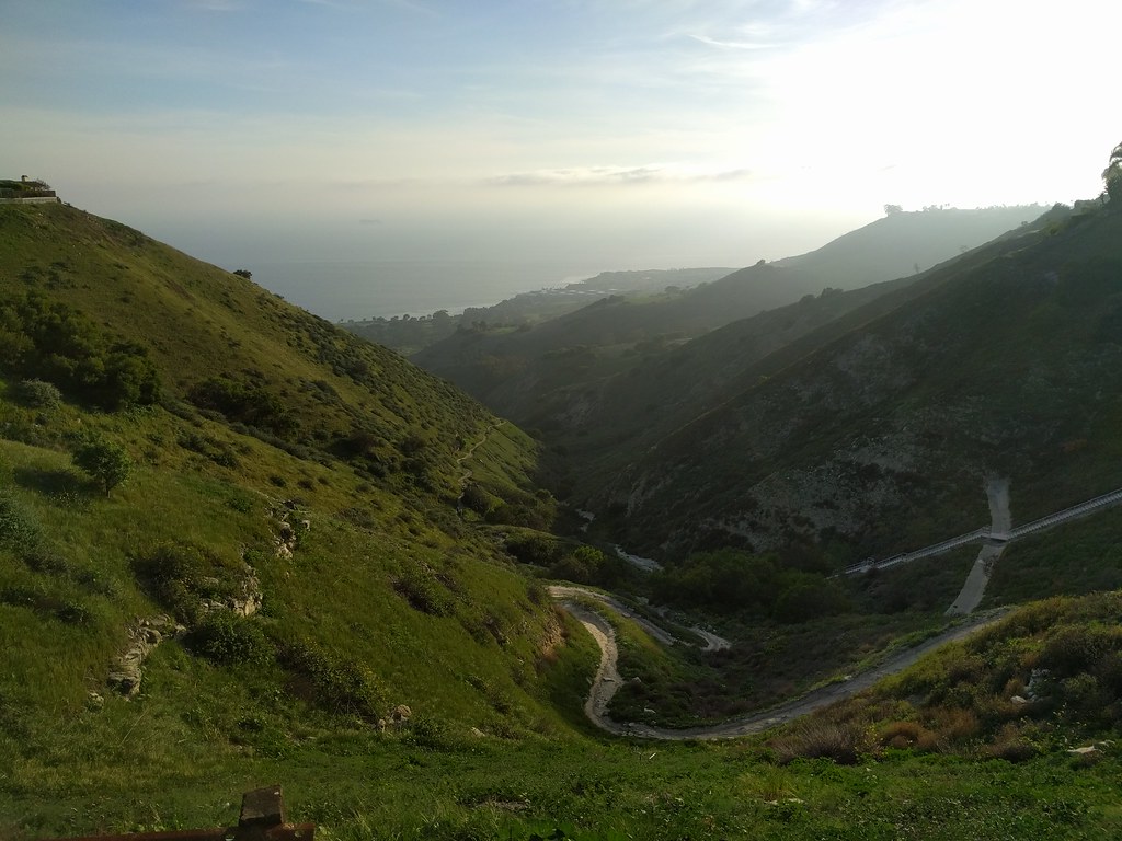
Looking down a green valley toward a hazy coastline. A path winds along the bottom, disappearing behind shadowed hills long before it reaches the sea.

We did eventually make it up to the top of the hill and the viewpoint. The ocean was covered in haze, completely blocking the view of Catalina Island and any chance of watching the patterns made by ocean currents and waves far below. That was fine. It wasn’t the highlight for either of us.
It’s been six months since we moved, but I’ve only recently started really exploring the area. I think I just got caught up in too much other stuff for a while.

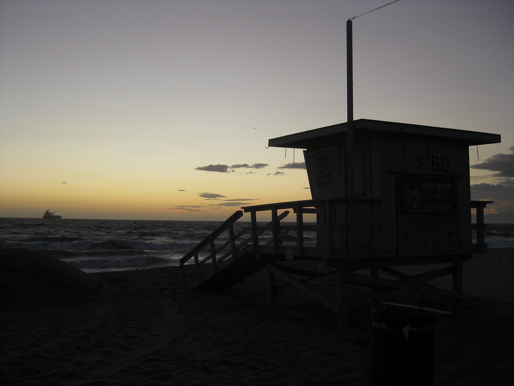
One day a few weeks ago, I tried to make it to the nearest beach I could in time for sunset. I missed…but while on the mostly-deserted beach I caught some nice views of pink underlit clouds over the Santa Monica Mountains, and this view of a closed lifeguard tower at El Segundo Beach.

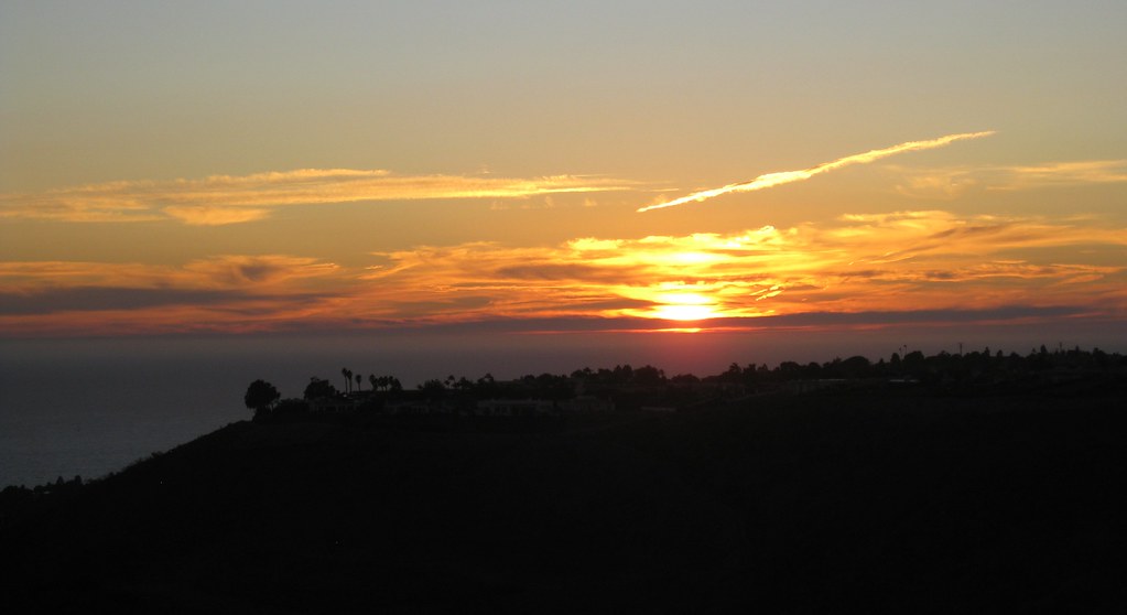
Then there was the clear afternoon when I went exploring the Palos Verdes area, looking for public parks where I could see the LA basin. Not much luck on that count, but as sunset approached, I decided to see if I could make it up to Del Cerro Park (more photos from this spot taken during daylight) up at the top of the bluffs. I did, and because the park is actually higher than the next hill over, I got to watch the sun set over the ocean and behind a hill at the same time.

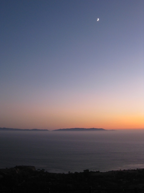
I stayed up there for a good 20 minutes after sunset, watching the sky darken through twilight. It was incredibly windy that evening, and even from a thousand feet up with no direct sunlight, I could still watch the waves between the mainland and Catalina Island, moving slowly through the strait like tiny ripples in the direction of the wind.

A couple of weeks ago I just had to get out of the house for an afternoon and found myself at the entrance to Peters Canyon Park. The last time I’d been there, the park was closed due to recent rains. This time, it was open.

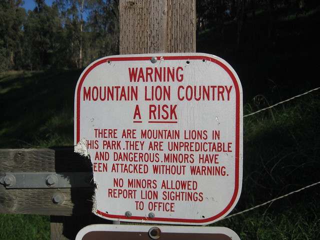
Several trails run from the entrance around the edge of the park, and one goes inward to an area that’s currently closed off. Because…well…take a look:

Damaged sign: Warning - Mountain Lion Country

I couldn’t help but take a picture. It went so perfectly with this sign I found in Hawaii near the active lava flows: Continue reading

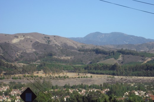
On a clear day in early October, I went driving up into the Tustin Foothills to see what I could see. I took a bunch of photos at a turnout, and also stopped at an intersection that gave me a nice view of Peters Canyon, the hills behind it, and Saddleback in the background. I used this photo a few weeks later for my drought post.

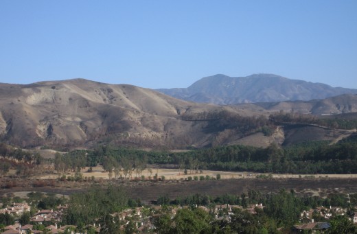
After the Santiago Fire, I waited for another clear day (which took several weeks), and set out to do it again and see just how far north the fire had reached. I managed to get a great pair of before and after photos from the intersection of Foothill and Lemon Heights.

Mt. Saddleback seen from Tustin foothills, October 2007
October 6, 2007. Click for a larger version

Mt. Saddleback seen from Tustin foothills, November 2007
November 24, 2007. Click for a larger version

While the orchards seem to have been spared, you can see the field in the foreground looks scorched, and most of the trees making up firebreaks seem to have died. More dramatic are the hillsides. Before the fire, you can see expansive dark patches of scrub, wide expanses of lighter dried grass, and occasional dark green bushes. Now it’s all dirt, except for the blackened remnants of the bushes. There are several gullies whose sides were hidden and softened by the ground cover, but are now starkly visible. And after this week’s rain, they’re probably eroded even more.

A few notes: The air was somewhat clearer for the “after” photo, and it was earlier in the afternoon, so the angle of the sunlight helped pick out terrain features a bit better.

It’s been a dry year for California. Water districts all over the state are geared up for drought conditions. The hills in the Orange County area are still golden-brown in mid-April. Last year at this time, they had finally turned green for spring.

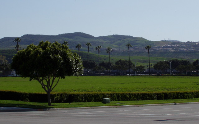
Here’s a shot from the Irvine Spectrum area from April 6, 2006:

Street corner, facing a vacant lot covered with green grass, in front of green hills with a clutch of houses to the right.

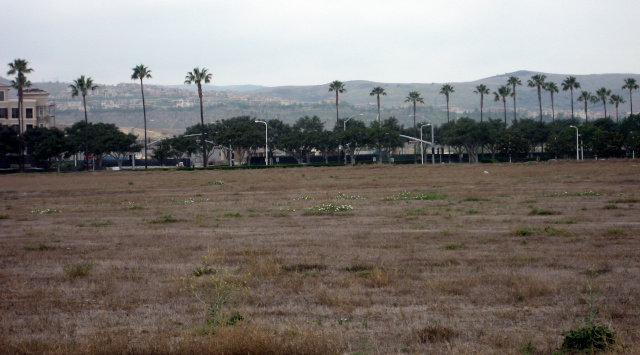
That’s not a lawn behind that hedge, that’s a vacant lot. You can see it’s just as green as the strip of maintained grass along the sidewalk. Now here’s a picture taken about half a block away, taken last week, on April 6, 2007 (no, the timing was not intentional).

Same lot, from a different angle, all dry brown stubble.  The hills in the background, a bit fuzzy, are also light brown.

This year, only a few weeds and flowers have managed to take hold in the vacant lot. Meanwhile, the hills are their usual golden brown. Somehow, I don’t think we’re going to see much in the way of wildflowers this year. Continue reading

On Sunday, March 11, a brush fire struck in the Anaheim Hills area. It was controlled relatively quickly, and by the next morning, the smoke had settled into a blanket of haze over Orange County.

Layer of haze in front of hills

For contrast, here’s a shot from a few weeks earlier (February 23), when it was unusually clear. This was taken from a park in the Quail Hill area of Irvine, looking across the Saddleback Valley from the south toward the same range of hills seen on the left of the picture above.

Quail Hill View