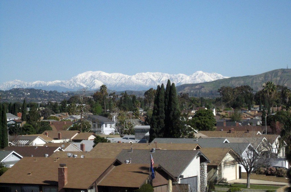
On my drive to work this morning, a gap in the clouds left this amazing view of the San Gabriels covered in snow from the last week’s worth of storms, lit up by the rising sun. By the time I made it up to Los Angeles, clouds had blocked the view, and I didn’t see any mountains for the rest of the day.
Tag: Mountains
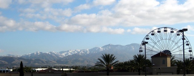
Cloud Puffs Over Saddleback
I’m going to have to start taking my regular camera with me to lunch. Yesterday I looked out and saw a huge, puffy cloud, virtually alone (beneath a thin layer of wispy cirrus), hovering above Saddleback.
When I stopped to take a picture, I realized that there was a whole line of little puffball clouds, tracking the mountain range exactly, but not appearing anywhere else in the sky. It really shows the effect that mountains have on cloud formation!
I decided to try for a four-shot panorama of the whole range.
It came out better than I expected, actually. I believe this is the first time I’ve stitched together a panorama using phone pictures. I used Hugin, which was a little hampered by the fact that I couldn’t find specs on the G1 lens type, focal length, etc., but it seems to have done reasonably well.
San Gabriel Snow and Clouds
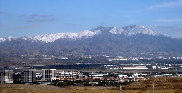
Yesterday morning on my way to work, I looked over and saw the San Gabriel Mountains practically glowing with the morning light of the sun. A layer of cloud blocked the sun where I was, making the distant peaks look that much brighter. I stopped at a spot where I knew I’d have a good view of the mountain range.
It turned out to be a really interesting view, as you can see from the panorama below.
By lunchtime, the sky above was mostly clear, and clouds were bunched up against the mountains, completely blocking them. I was indoors most of the morning, but it seemed as if the cloud layer had just blown northward until it hit the mountains, then stopped.
Click on either image to go to its Flickr page.
Side Note: Stitching
Since Canon’s PhotoStitch no longer works on Snow Leopard, I’ve tried out Hugin again. It’s come a long way since I first tried to use it and spent hours just getting a panorama to break up spectacularly and went hunting for PhotoStitch on the disc that came with the camera! I can’t get it to automatically detect control points on Fedora, but it does a surprisingly good job even when I’ve only marked around 10 or so. The ability to customize things like which pieces appear in front of others, or which projection to use, has turned out to be useful as well.
Mountain Silhouette
It’s cool that sunset/sunrise can make distant mountains stand out in silhouette even when they fade into the haze in broad daylight. The San Gabriels to the north, the Santa Monica Mountains to the northwest, Signal Hill Palos Verdes* to the west, and even a small segment of Catalina Island to the southwest were all visible, though I don’t remember seeing any of them during the day today.
I remember riding in a shuttle back from LAX once before dawn, and I could swear that I could see the silhouette of the San Jacinto Mountains from Los Angeles. They’re out near Palm Springs. Not exactly something you normally see from LA.
*There’s a wedge-shaped hill that’s visible in the west from north Orange County on really clear days. Somehow I had it in my head that it was Signal Hill, but I noticed when I went to Long Beach Comic Con a few weeks ago that (a) I passed the city of Signal Hill on the way to the con and (b) the hill I can see from Orange County was still visible to the northwest from Long Beach. Thanks to Google Earth for helping me figure out just what hill it actually was!
San Gabriel Mountains Emerging From Smoke
The wind’s changed, the weather’s cooled off, and firefighters are starting to get the Station Fire under control. For the first time in days, we’ve been able to see the San Gabriel Mountains.
The eastern part of the range was clearly visible this afternoon — more visible than it usually is during the summer, with LA’s famous smog. The middle was completely shrouded in smoke. Interestingly, while it looks like the plume is being blown east, visibility seems to be worse toward the western end. Maybe wind near the ground is blowing west, and wind higher up is blowing east?
Compare to this shot of the mountains covered in snow last December: