I’ve never been a fan of actually using GPS navigation. Sure, I’ve always thought it was insanely cool that it was possible, I just didn’t want to use it myself. For unfamiliar destinations I generally prefer researching a route first, and for familiar ones I generally prefer just relying on my local knowledge. But I’ve found something that I do like using it for: Traffic.
I recently started a new job, exchanging a fairly short commute for a ~40-mile trek across the Los Angeles freeway system. Under ideal conditions, it’s about 45 minutes. When the freeways are bogged down (i.e. when I’m actually going to be driving), it can take an hour and a half or more.
When I landed the job, I replaced my phone with a G2. It’s a heck of a lot faster than my old phone, plus it can handle newer software…like Google’s turn-by-turn navigation app for Android. After trying a couple of different routes the first few days, I tried it out…and discovered that it factors in live traffic data when calculating the remaining time.
The upshot: I can walk out the door, start up the app, and figure out which of three main routes will get me there fastest. (Well, least slowly, anyway.)
Of course, it’s not perfect. It’s based on traffic now, and over the course of a predicted hour-plus, the route could easily get more congested. That’s not even counting potential accidents. It does seem to update frequently, though, and knowing I’ve avoided a 100-minute drive in favor of 70 minutes really outweighs the annoyance of a mechanical voice telling me how to get to the freeway from home.
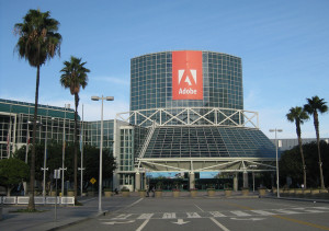 I do have to remember not to rely on it too heavily at the end of the trip, though. I left it on by mistake after selecting my route to the LA Convention Center for Adobe MAX this morning, and instead of turning it off, I let it direct me straight past the parking garage.
Oops.