I don’t remember much about Marineland of the Pacific. It was an ocean park/aquarium like Sea World that operated near Los Angeles for several decades, closing in 1987. I know I visited at least once, with my grandparents, but all I remember is:

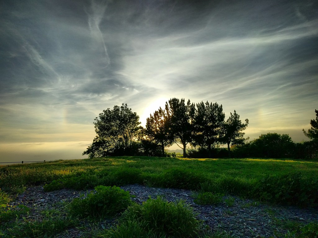
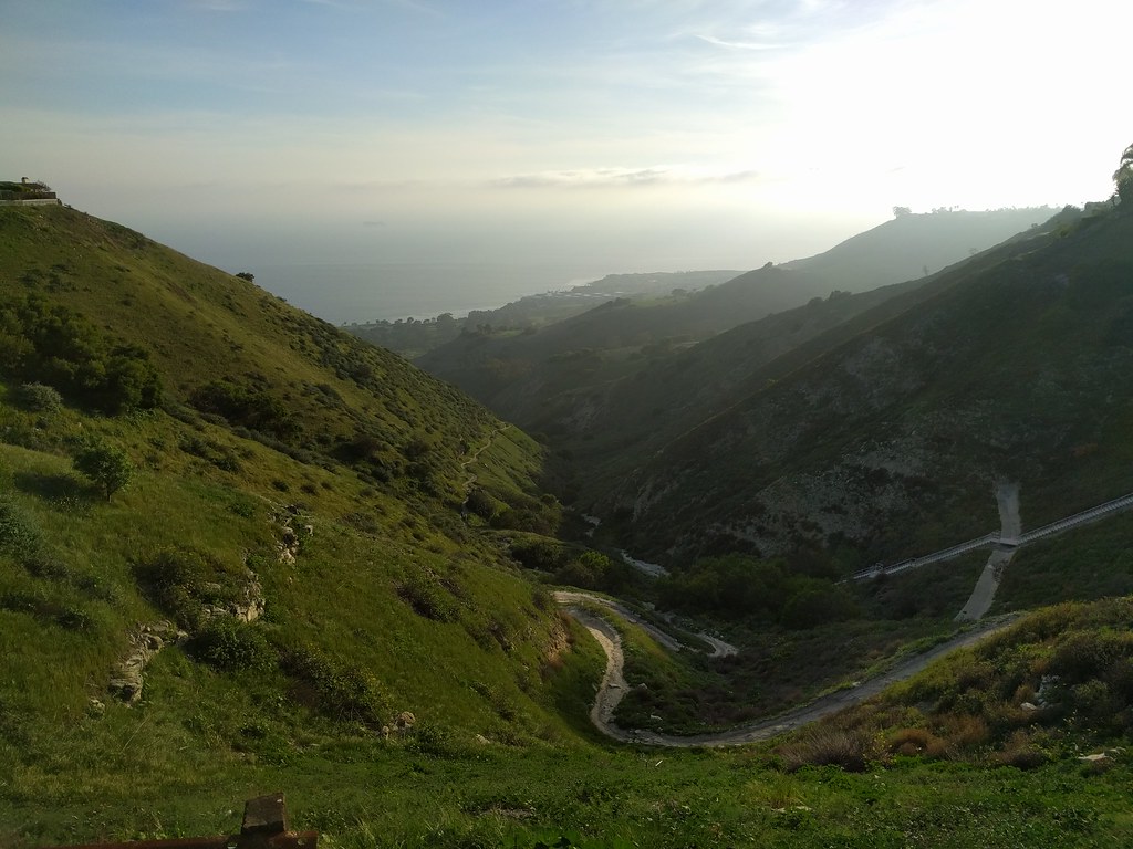
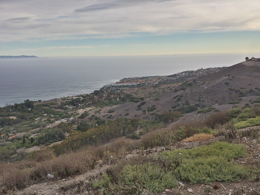
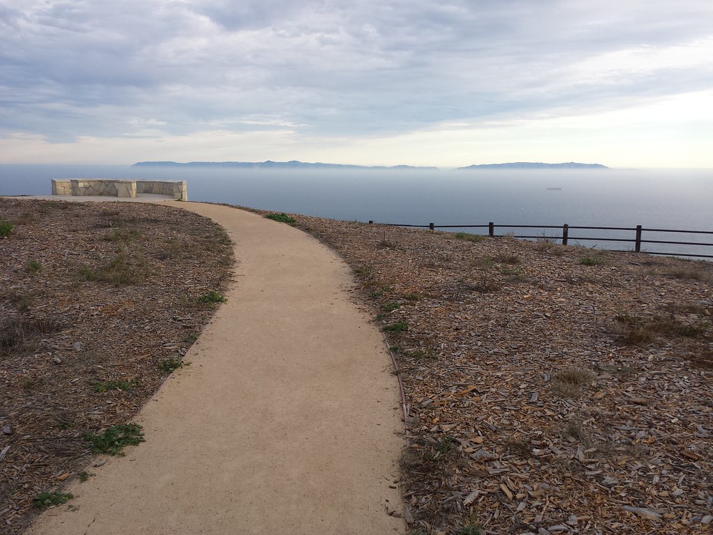
  1. The view from what I assume was Palos Verdes Drive, as the car crested a low summit, brown hills rising to the right and falling gently toward the ocean on the left. The park stood on a promontory jutting out into the ocean. I haven’t been able to locate the spot, but that could just mean the road’s been moved.*
  2. A sign saying “CAFE” visible from the parking lot, which I misread as rhyming with “safe.” (Evidently I was very young at the time.)
  3. That’s about it.

You’d think I’d remember the sea life at least a little, though I suppose it’s possible I’ve misattributed some memories to Sea World (which, come to think of it, I don’t remember super-well either).

Not much of Marineland remains aside from a few names at Terranea Resort, which now occupies the site. But a piece of that history is coming back. In 2014, a 35-foot whale statue from the park entrance was found in a maintenance yard. The city has approved plans to place the statue at Point Vicente Park just up the road.

Apparently the decline and closure of the park was rather sordid: HBJ, the textbook company that owned Sea World at the time, had tried to buy Marineland’s star orcas. They weren’t selling. So HBJ bought the park in December 1986. Late in January, they secretly loaded Orky and Corky onto trucks in the middle of the night and drove them down to San Diego. A week later, they announced the park would close in March. They shut it down halfway through February, and by May they’d sold off the property to a real estate developer. Plans for a conference center were never realized, and the site was abandoned for 20 years until construction began on Terranea.

*Update: My dad pointed me to the Wikipedia article, which led me to a post at Modern Day Ruins, which led me to the California Coastal Records collection of aerial photographs. I found one from 1986 that indicates that Rancho Palos Verdes Drive is in the same spot as it was back then, but the housing developments on either side to the east of the turnoff weren’t there at the time. That’s probably why I didn’t recognize it. Or the road I remember could be the one down to the parking lot.

A whole lot of wispy clouds, plus fragments of a glowing circle above a green landscape. A grove of trees is silhouette against the sun.

After an afternoon of ice skating, I talked the family into making a quick trip up to Del Cerro Park in Palos Verdes. It takes a while to get there from home, but since we were already up in the hills for the ice rink, it was about five minutes. My original plan was just to walk out there myself, spend five minutes enjoying the view and taking pictures, then head back, but the five-year-old wanted to come along rather than wait in the car with mom.

Of course kids have their own pace, and while he wasn’t terribly interested in looking out at the ocean from a hilltop a few thousand feet up, he was fascinated by a lot of the other things along the way, which was how we ended up getting close to the hilltop at the right time for this view of the sky, sundogs, cirrus clouds, criss-crossing contrails, and silhouetted trees.

To be honest, he wasn’t terribly interested in that view either. At five, checking out foxtails and giant clover and gopher holes and fragments of concrete slabs (in a suspiciously flat and rectangular depression) and looking for the entrance to an incredibly long stairway and climbing and balancing on logs and looking for “the actual park part of the park” (i.e. the playground) are more appealing, and I barely had a chance for this moment to register.

Looking down a green valley toward a hazy coastline. A path winds along the bottom, disappearing behind shadowed hills long before it reaches the sea.

We did eventually make it up to the top of the hill and the viewpoint. The ocean was covered in haze, completely blocking the view of Catalina Island and any chance of watching the patterns made by ocean currents and waves far below. That was fine. It wasn’t the highlight for either of us.

Del Cerro Park sits atop a hillside overlooking the Pacific Ocean and, in the distance, Catalina Island off the coast of California. Suburbs surround it on the inland side, but the hills rolling down to the sea remain mostly open space (though to be fair that’s in part because the land isn’t stable enough to build on).

Normally I can put the car right in the lot when I go there. On the afternoon of January 1, I had to park all the way on the other side of the gorge that separates the outcropping from the rest of the neighborhood. I can’t complain, because I got to see this view on the way over…and on the way back, after sunset. Continue reading

Chaparral-covered hillside rolling down to a coastline, flat ocean and gloomy sky, blue visible in the distance.

Del Cerro Park, at the top of the Palos Verdes Peninsula, on a super windy evening. I saw two tumbleweeds roll by, and kept worrying I’d drop my phone while taking pictures.

I need to get out here (and other scenic spots) more often. Even though it’s not that far (one of the great things about the LA area is how close it is to sea, mountains, deserts, forests and so on), it’s so easy to get caught up in the day to day grind that you forget to step out and visit what’s right there, on the other side of the traffic and smog.

Dirt path curving away toward a hilltop with a bench. Only ocean and sky are visible beyond the hilltop

Photo album on Flickr: Del Cerro Views
Originally posted on Instagram

It's gloomy. The sky and sea are almost the same shade of gray. Looking along a steep cliffside toward a rock outcropping. It's high, maybe ten times as high as the low building perched on top of it, and grooves show dozens of layers stacked from the sea below to a bit below the top.

The Palos Verdes peninsula sits at the southwest corner of Los Angeles. Parts of it are built up in old, grid-style suburbs. Other parts are of the more modern, winding type. And still other parts remain open space, due in part to the unstable geology of the area. Parts of Portuguese Bend are sliding toward the ocean, requiring frequent repairs of the main road along the coast. Way back in 1929, a housing development began sliding into the ocean. Abandoned now, the area remaining above land is known as the sunken city.

Adjacent to those ruins is Point Fermin Park, an ordinary city park that sits atop the cliffs. The Point Fermin Lighthouse (previously featured here) looks over the sea, and a fenced walkway runs along the length of the cliffs.

Looking out here, you can see the layers of rock, and understand how parts of the point could just slide away. The warning signs on the fence don’t surprise me, but I have to wonder just who would want to climb out there.

Photo challenge (WordPress): Layers

It's a cloudy day. Behind a white picket fence and green lawn, there's a whitewashed, gabled housel Most of it is two stories, but a square tower in the middle rises two more levels, and the tower is topped with a railing above which which you can just glimpse the top of a glass structure.

Point Fermin Lighthouse in San Pedro, California, at the southern tip of Los Angeles.

The Victorian lighthouse is surrounded by a city park, and the park is lined with a walkway along the top of the cliffs by the sea. Off to one end is the infamous sunken city, a suburban development that was abandoned when the land started sliding into the ocean. I took a whole slew of photos as I walked along the clifftop, and you can see the seven best on Flickr.

This is one of three lighthouses in the area that I considered driving to over the weekend for Instagram’s weekend hashtag project (theme: lighthouses), figuring it had the best chance of clear weather. No such luck. (Update: I have since been to Point Vicente many times, but I can’t remember what the third one was. Maybe the one in Long Beach by the aquarium?)

Strangely, the phone picture I chose for the project turned out to be more striking than the better shot taken with my camera. I was trying to keep the lamppost separate from the house, but it turned out I shouldn’t have.

I’m always surprised when that happens, even though it’s not that uncommon an occurrence.

The same house, but this time it's sepia-toned and fading darker toward the corners. It fills a a square frame with a border that makes it look like the holder in a really old photo album. And the angle is just different enough to make it look fuller, or bulging, or perhaps even looming above the viewer.

Photo Challenge (Instagram): Lighthouse

After a failed attempt yesterday, I was even more determined to try to spot comet Pan-STARRS tonight when it would appear near the moon. Naturally, the morning was fogged in, and the fog bank remained on the western horizon all day. I looked on Google Earth for a nearby hill with a western view and public access, and I found Fred Hesse, Jr. Park in Rancho Palos Verdes.

I arrived just minutes before sunset, and found thirty or so people lined up along the western edge of the hill with telescopes, binoculars, and cameras on tripods. It reminded me a lot of the eclipse I watched last May (also in Palos Verdes, though at a different park).

Hesse Park has a clear view to the west and southwest, with open space below, then houses, then the tops of the clouds. (I’m not sure what’s usually visible below the cloud layer). Off to the southwest you can see the northwestern section of Catalina Island. To the north you can see Malibu and the Santa Monica Mountains. Way off to the northwest you can see some of the channel islands.

Continue reading