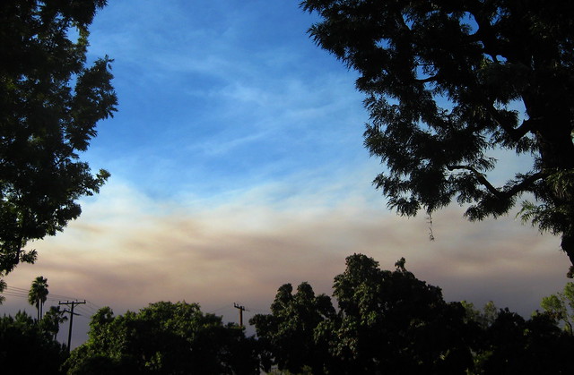
Smoke from various fires up near Los Angeles and Corona, creeping across the sky into Orange County.
Smoke from various fires up near Los Angeles and Corona, creeping across the sky into Orange County.
The change in the weather has brought in clouds today (Saturday), and even the occasional sprinkle of rain. It apparently helped slow the Santiago Fire considerably.
I went into work this morning to deal with some network problems (you may have noticed that this site was down for a while), then went over to the Spectrum to grab lunch and take a look at Leopard. (Incidentally, my plan seems to have failed: Amazon shipped the box yesterday, so I’ll have it in just a few days. And I’ll really want to put it on the PowerBook.) I went up to the top of the parking structure to take a look at what was visible.
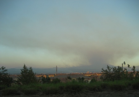
There’s considerably less smoke than yesterday, and you can see the beginnings of a layer of haze below the hills. The cloud of smoke peeking out from behind the lower peak just in front of Saddleback stayed there, without getting visibly larger or smaller.
The air’s been relatively clear, except for the fertilizer smell when I walked out of the office. People were out shopping and sitting at outdoor tables. I saw one woman walk by with a face mask, but everyone else seemed to be taking things as normally as possible.
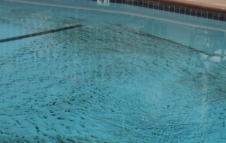
The apartment complex cleaned out the pool, which a few days ago had intricate patterns of ash lining the bottom.
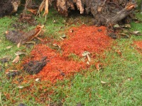 They also finally cleared away the remnants of the tree that collapsed on Sunday. They chopped it up into smaller pieces, and moved it off the sidewalk, but left the stacks of logs, branches, the stump and piles of sawdust sitting on the lawn for the rest of the week. After a day or so, the sawdust turned almost bright orange. My best guess is that they ran the sprinklers.
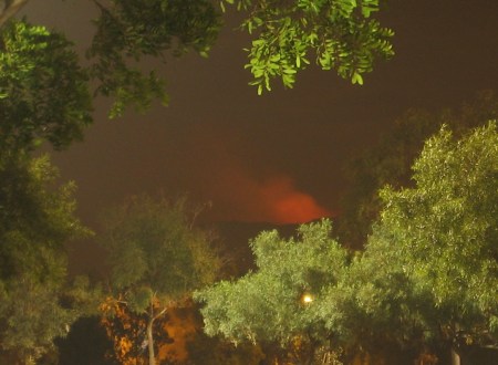
Of the two co-workers who live out in Silverado, one cleared out on Tuesday, while the other stayed to help out with, well whatever he could. Putting out spot fires, rescuing animals, scouting. His wife has been sending out email updates whenever he manages to contact her. I ran into the one who evacuated at the office today (he frequently comes in on weekends). At the time, the prognosis didn’t look good, but now it sounds like the canyon homes were spared for another day.
It still wasn’t encouraging when, walking to the Corner Bakery at the Tustin Marketplace tonight, Katie and I were again able to see a red glow in the mountains. We went looking for a spot where I could both steady the camera and see the glow, and finally set it up on one of those waist-height light poles lining the entryways to the parking lot.
The glow brightened and dimmed several times while we paused.
This is a 10-second exposure taken around 8:50 PM. You can see how well-lit the parking lot is by looking at the trees. I suspect the Marketplace is the primary reason we can’t see as many stars from home as I’d like.
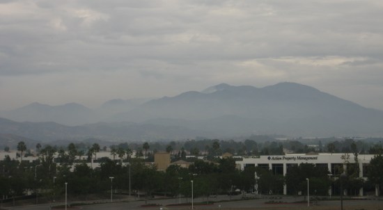
Winds have shifted northward. The good news: my workplace is no longer drenched in smoke from the Santiago Fire. I can see blue sky and wispy clouds, terrain back to the nearby hills, and the twin peaks of Saddleback rising above the smoke. Reportedly the northern peak (the one without all the radio transmission towers) has burned, though it’s hard to tell at this distance. The bad news: it’s sending the flames straight at Silverado Canyon, which was spared earlier this week when the fire raced past it eastward. Once again, worried about the co-worker who stayed behind and spent the last few days rescuing animals and relaying information.
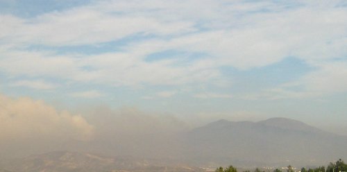
The Santiago Fire has moved up into the mountains, raging through the Cleveland National Forest. The canyons are still under evacuation, but out here in the Saddleback Valley, it just looks like a really smoggy day. With yellower-than normal sunlight. It was actually cold this morning, for the first time in well over a week.
Things were just clear enough at home last night that we opened the windows for about an hour to air the place out. Then the smell of smoke started drifting in again.
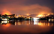
Because there hasn’t been much to see since Thursday, I haven’t been taking as many photos. So instead I’ll point you to a couple of nighttime photos I found on Wikipedia’s article on all the fires. The one on the left is a view from Aliso Viejo across the valley (the Washington Mutual building at the lower left is half a block from the comic store I frequent) by Wikipedia user Bighead. The one on the right is a view from Mission Viejo by Kevin Labianco. His other photos on Flickr are worth looking at as well.

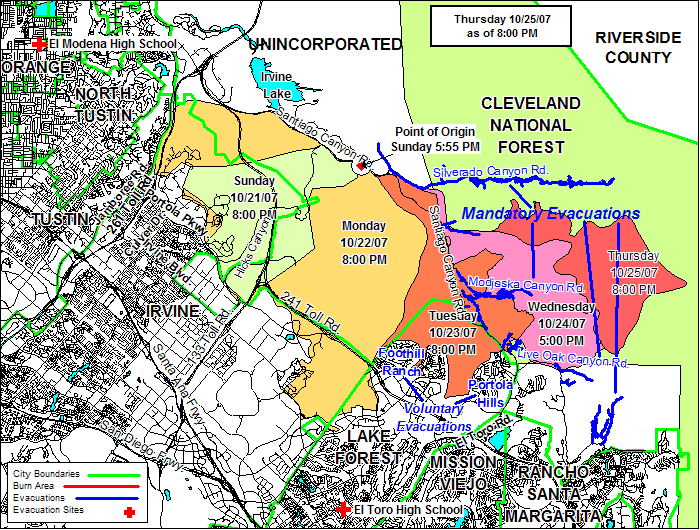 The OCFA has posted a nice map showing the progression of the fire. Since they replace their maps every day or so, the thumbnail links to a local copy of the map. (via AerynCrichton)
I’ve noticed people starting to speculate on terrorism as a possible cause of the fires, because it’s awfully suspicious that they’d all break out at once. Well, no, actually: it isn’t suspicious at all. Southern California is a very dry region. It rains in the winter (well, usually), then dries out in the summer. By the end of summer, the grasslands and brush are basically tinder. Then the Santa Ana winds blow in, usually in October: high speed, high temperature, low humidity. They dry things out even further, spark power lines, and once a fire has started (by arson, accident, etc.), make it spread rapidly. To make matters worse, there’s that drought I mentioned last week.
So if conditions are ideal (so to speak) for fire in one place, they’re usually ideal all over the region. We get wildfires every year, often two or three at once. They don’t get the headlines when they’re out in the wilderness, only when they encroach on cities and homes. And sometimes, when conditions are really bad, we get massive fires across the region. It’s happening now, it happened in 2003 (with the Cedar Fire being the largest), it happened in 1993 (the nearby Laguna Beach fire being only one of several).
In short, California burns regularly. People can help that process along, but it happens. Could terrorists have started some of the fires? (So far, only the Santiago Fire has been identified as arson.) Possibly. But it’s hardly the most likely explanation.
Had a chance to run through all my Santiago Fire photos from the last few days with Katie and my parents, and they picked out a few favorites that I hadn’t already posted.
This first one was Monday morning around 10:30, as I drove into the region covered by the smoke plume.
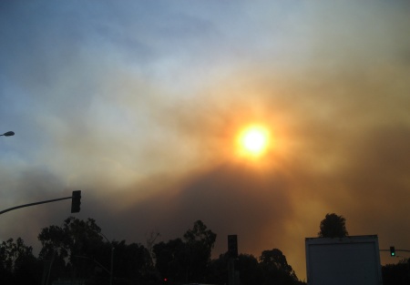
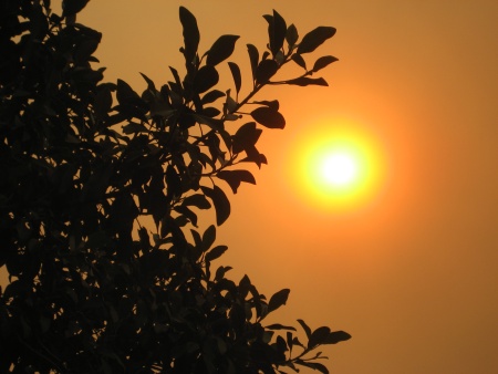
Just a few minutes later, I had parked at work, deep within that plume. The sky was a hazy orange-brown, and the sun was bright orange, as you can see looking up at this tree.
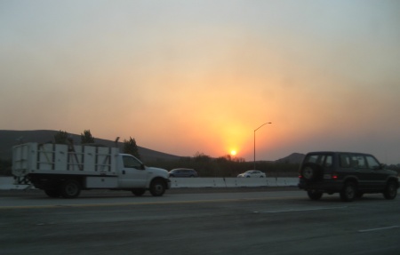
This next picture is yet another view of Monday’s sunset, seen from the 405 near Sand Canyon. This shows more variation in color, with a distinct cone of bright yellow surrounded by red, bounded by gray on the sides and fading to blue above.
Finally, here’s a view from the Quail Hill area on Tuesday just before sunset. This was taken from Knollcrest Park, roughly the same view as last month’s lenticular cloud photos. This is looking across the Saddleback Valley toward the Santa Ana Mountains. The smoke has cleared enough to see silhouettes, though the light has faded too much to see any more detail. The large plume is rising from Mt. Saddleback, the highest peak(s) in the range. The sun is very close to setting: the houses nearest the ridge are already in shadow, with the next row still in light.