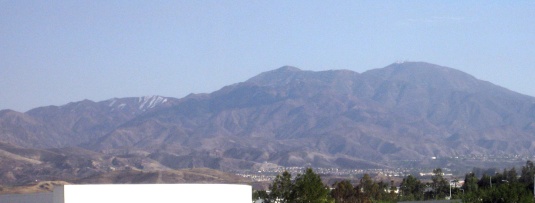
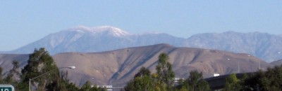
Last January when I caught a view of the entire range of the San Gabriel Mountains absolutely covered in snow, I figured it was a once-in-a-lifetime sight. Sure, they get snow every year, but they usually don’t get that much snow.

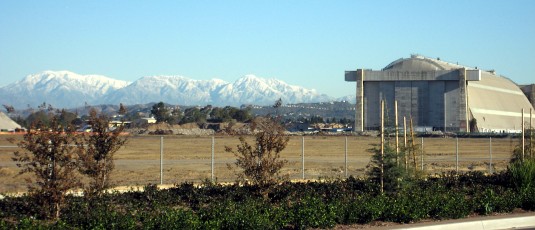
Amazingly, I got to see something similar again today. In a way, even better, because this time the sky was clear, providing better light and an unimpeded view.

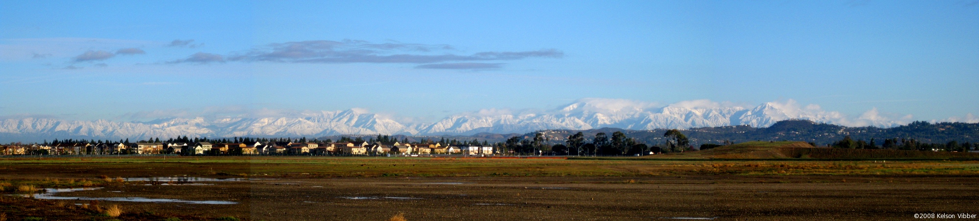
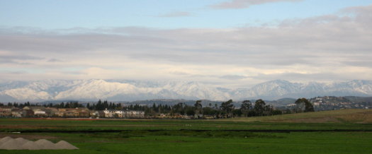
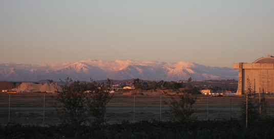
After yesterday’s rain and a prediction of more showers today, I was surprised to see empty blue sky this morning. While driving over a bridge I looked out the window and saw the mountains just coated with snow. As soon as I dropped Katie off at her office, I made a beeline for that spot near The District in Tustin that (for now) offers an unimpeded view of the mountains that dominate the skyline (on clear days) of Los Angeles County.

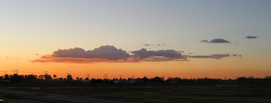
By then a few clouds had begun to swirl around in the distance.

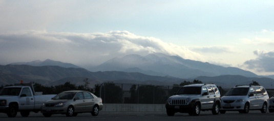
I couldn’t tell at the time whether Saddleback had any snow or not, since it was still backlit (this was around 8:20 or so in the morning), so I didn’t take any pictures of it.

Here’s a panorama of the mountain range. Click on the image below to see the full thing.

We went to The District on Saturday afternoon to catch Cloverfield and check out the Auld Dubliner. I took the Warner exit to go in the back way, and noticed someone standing out on the shoulder of the ramp, taking photos. I looked out past the wide expanse of empty fields and was astonished to see the entire San Gabriel mountain range covered with snow!

Not just the tops of the mountains on the eastern half of the range, but everything, even the lower parts you can just barely see by the Cajon pass, and this huge expanse north of Los Angeles that I’m not sure I’ve ever seen covered.

San Gabriels (mid-range) covered with snow

I pulled over as soon as I found a spot I considered safe, then walked back up to the top of the ramp. I talked briefly with the man I’d seen taking photos, and he said he’d lived in the area for 50 years and had never seen the mountains like this. He also mentioned he had a friend who had served at the base*, and he was going to send him the pictures.

I ended up taking a 12-photo panorama (zoomed) spanning at least 120° from the blimp hangar on the left, across the San Gabriels, past the hills above Orange and Tustin, the foothills of the Santa Ana Mountains, on to Saddleback, which had a few bits of snow clinging to the mountainside.

San Gabriel Snow Panorama
Click to view panorama (424 KB 6648×500 JPEG)

*This is the location of the former MCAS Tustin. The Marine base was closed in the mid-1990s, and the land is only just starting to be developed—notably The District in one corner, which is what brought us to the area yesterday.

Update December 18, 2008: This post is getting a lot of traffic today, but it’s from last winter. If you want to see photos from this week’s snow, check out Misty Mountains: Another San Gabriel Snow Panorama from the same spot on Tuesday, December 16, and my Snowline photoset on Flickr, for those pictures and several of Saddleback and the Santa Ana Mountains today.

There was a little snow on Mt. Saddleback on Sunday, but not much worth mentioning. Sometime early Tuesday morning, though, a freak storm seems to have hit the mountain… and only the mountain. We certainly didn’t get any rain down here in the flatlands.

At 8:20, the mountains were still shrouded in clouds:

Mt. Saddleback and hills shrouded in cloud.

By 9:00, the clouds were starting to burn off, leaving behind a coat of snow, not just on Santiago and Modjeska peaks (still behind clouds), but on the lower peaks to the northwest.

Mt. Saddleback topped with cloud, the peaks next to it covered in snow.

By noon, most of the snow had melted. There’s still some in the shadowed crevices.

Mt. Saddleback with just a little snow remaining.

UPDATE DECEMBER 19, 2008: This post is getting a lot of traffic today, but it’s from last winter. If you want to see photos from this week’s snow, check out my Snowline photoset on Flickr

After the last few days of rain, today was clear and windy. I finally dragged myself out to a vantage point where I could see something of the mountains… just at sunset. This is looking northeast toward the San Gabriel Mountains from the edge of a vacant lot on the former MCAS Tustin. (You can see one of the two blimp hangars at the right.)

Snow-covered San Gabriels and blimp hangar at sunset

Update: Monday morning I went back to the same spot before work and took some photos in daylight. Katie said it looked like someone had sifted powdered sugar over the mountains.

San Gabriels, capped with snow, and blimp hanger in daylight

Back to Sunday evening, I crossed the street and got some more pictures without the fence and saplings in the foreground, and stayed out until the light had faded. The view was clear all the way west along the range to Mt. Wilson. I also looked back toward the sunset, which lit up the edges of a cloud with a red-gold glow.

Cloud backlit by sunset

Distant mountains with one peak lightly dusted in snow

Okay, so it’s ~40 miles away (and likely to stay that far, barring a freak storm or new ice age), and it’s not much (compare this April 2006 view)…and I half-suspect it’s all melted by now (this photo was taken Monday morning, and it looked lighter by Tuesday), but still…

Say, all those places that are getting flooded—we’d be happy to take some of that extra water off your hands.