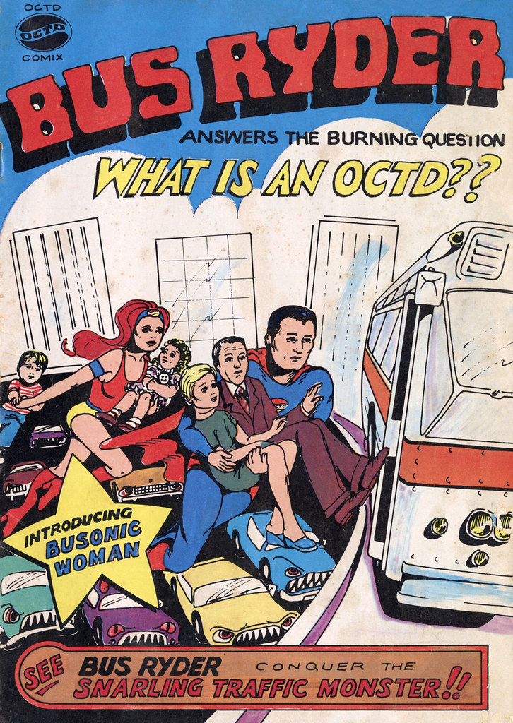
Apparently this was a 1976 comic book to promote the then-new county bus system with campy knock-off superheroes (and really wonky perspective). I mean, Bus Ryder looks suspiciously like Superman, and there’s no question where the Busonic Woman got her name.
Tag: Orange County
Looking Back at Camp Myford
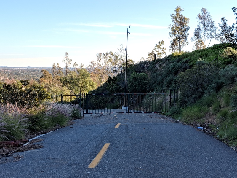
I’ve been looking through photos from back when we could, you know, go places and found a set from the hills above North Tustin during a year that we got enough rain to turn the hills green. There were some really clear shots of Peters Canyon, Saddleback, and even some south Orange County hills that I couldn’t identify. There was a spot that I remember being a turn-out that’s finally eroded away to the point that it’s been fenced off.
And there was this gate, which I think might have been across the road to Camp Myford, a Boy Scout camp on the Irvine Ranch that closed back in the late 1980s. I remember working as a camp counselor for a Cub Scout day camp during the last month — possibly the last week — it remained operating, before the bulldozers came in.
I remember lots of eucalyptus trees, hiking trails and dirt roads, a couple of buildings (though I couldn’t tell you what was in them), a fire ring, and a whole lot of giant pipes that were going to become the sewers and storm drains of the housing tract that was going to be built any moment now. And I remember being told in no uncertain terms that we were supposed to watch our language around the impressionable younger boys (who were, of course, a lot more foul-mouthed than we were).
And I found this article through the Tustin Area Historical Society, summarizing the history of the canyon as far back as the Mexican Rancho system, when it was named Cañon de las Ranas (Canyon of the Frogs) because it drained into the Newport Back Bay, known then as the Marsh of the Frogs.
Peters Canyon was once Canyon of the Frogs
Camp Myford, an Irvine Co. gift to the Orange County Council Boy Scouts of America, was named for James Irvine’s youngest son. Peter’s Canyon Regional Park offers a well-used oasis of wilderness amid the sprawl of development in the North Tustin area…
The Visible Housing Timeline
I saw an article about open space preservation efforts in Newport Beach, and decided to look up the area on maps’ satellite view. Looking around nearby areas in Newport, Laguna Beach, Irvine, Tustin, Orange, etc, I realized: the timeline of residential development in central Orange County is actually visible.
- Newer neighborhoods have bigger houses than older ones.
- Older neighborhoods have varied muted colored roofs. Newer ones are almost all red tile.
- With some exceptions, older areas were built on flatter land & newer areas have crept into the hills, so grids are mostly older. The one newer area that’s flat-and-grid is all red tile roofs.
I don’t know how well it tracks for other areas. I’m less familiar with southern Orange County, for instance, and areas from Santa Ana northward into the LA Basin are much flatter and were largely built-up by the time I started paying attention.
County Fair-Pocalypse
On Thursday I took the day off from work and we went to the Orange County Fair. It was a particularly bizarre visit because Costa Mesa was beneath the smoke plume from the Holy Fire (so named because it started in Holy Jim Canyon) burning in the Santa Ana mountains.
The sky, except for clear blue patches to the west and south, was a yellowish brown. The sunlight was dim and yellow.
When we arrived, the entire ticket sales system was down. All the booths. All the self-serve kiosks. You couldn’t buy tickets for any of the rides, unless you could find one of the wandering cash-only ticket sellers, roaming the fair like quest-giver NPCs.
We did eventually find someone who could sell us tickets. At that point, the sun emerged briefly through a break in the smoke. The deep red-orange disc was dim enough to look at comfortably, and lit up the fissures in the cloud a lurid red.
Fair food keeps getting more and more outrageous. Deep fried Twinkie dogs and Zucchini Weenies have been joined by triple-decker donut burgers, chicken-in-a-waffle-on-a-stick, and the donut chicken and ice cream sandwich. But for sheer “because we can” ridiculousness: deep-fried filet mignon. What a waste.
It was early evening by the time we left, and as we walked to the gate closest to where we’d parked, we saw a bright orange line in the distance. Was it the glow of the flames behind the mountain? Or the flames themselves on top of the ridge? We were too far away to tell. But that line shimmered, and we watched a deeper orange glow appear and fade behind another part of the ridge. It’s hard to be sure, but I think it might be burning in the valley between the two peaks of Saddleback.
Saddleback Snow, New Year’s Eve
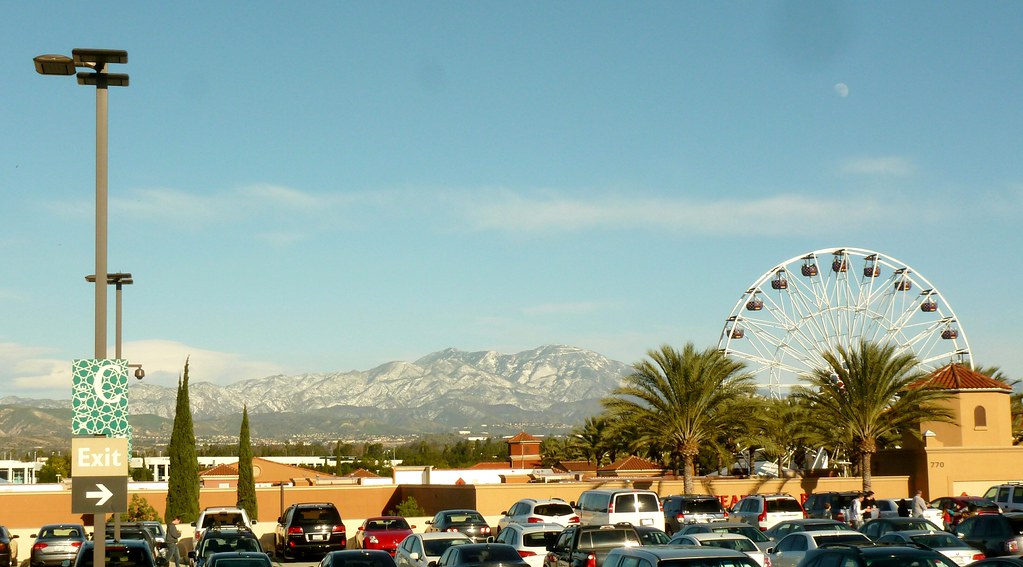
I was expecting to see more snow on the San Gabriel mountains after yesterday’s storm, but was kind of disappointed…until it became clear that the bulk of the snow was on another mountain range. Saddleback was bright white, visible shining as far away as Carson as we made our way toward Orange County. Snow not only reached further down the slopes than usual, but even the mountains to the south were dusted with white, which has never happened in my memory. (If I have my bearings right, they’re just west of Lake Elsinore.)
Since we were going to the Irvine Spectrum on our way to our evening plans, I figured I’d try to match some scenic views from years past before we headed into the mall to take the kiddo to the ice skating rink and Ferris Wheel.
Exploring the Creek (Two Photos)
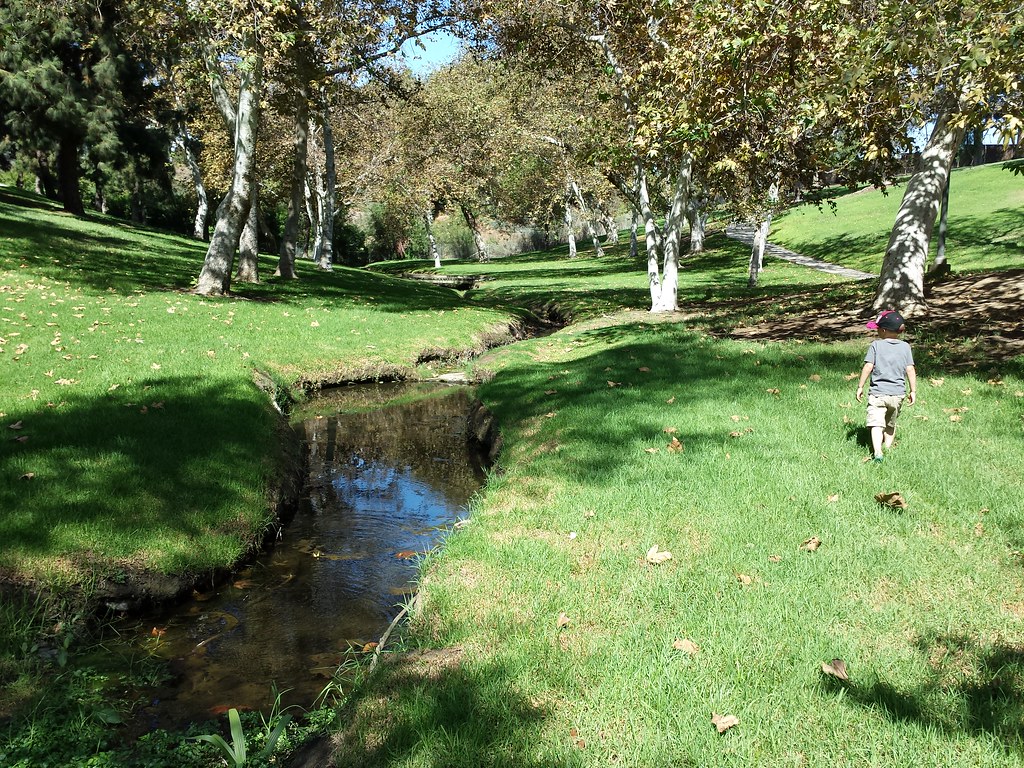
It was a late-summer heat wave, and while the picnic itself was spread out in the shade beneath some trees, it was over 100 degrees. Still, a preschooler can’t be terribly interested in his parents’ old school friends catching up, and my son kept trying to wander off to play in the hot, hot sun.
Finally, after lunch, I decided instead of bringing him back I’d go with him. On the other side of the hill we found a small concrete-lined channel, amazingly with water in it, then followed it upstream to where it opened up into a stream running through the grass.
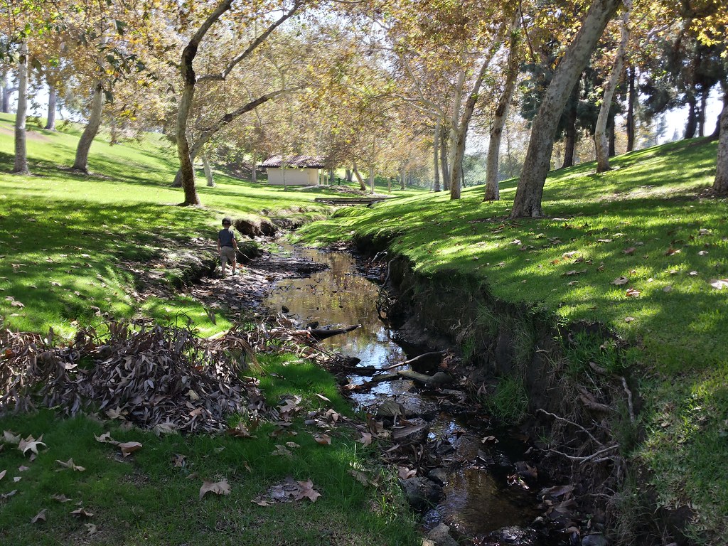
Further up we found a wooden foot bridge, and then trees closed in around it. The shade was very welcome!
This second photo is looking back downstream toward the open area. Just behind me there’s a chain link fence that marks the edge of the park, and a hill leading up to the road. The stream is fed from a drainage pipe, and judging from the erosion patterns, it picks up a lot of runoff during the rainy season.
I took both shots with my phone in HDR mode to get both the light and shade areas clear. Unfortunately on the second shot it ended up blurring the leaves, since they moved just enough in the breeze between bracketed shots. It looks great on a small screen, though!
California Drought Sim, Water Use, and Preserving Open Space

Researchers simulated a 70-year mega-drought and came up with ways that California could survive without the economy collapsing, emptying out the state, or even abandoning agriculture. We’d have to change the way we store and distribute water, recycle more wastewater, do groundwater replenishment, prioritize different (and less thirsty) crops, and of course cut down on our water use. It would hurt, and smaller, rural towns would be worse hit than cities (which is already happening — there are places out in Tulare county, for instance, where wells are drying up and homes no longer have running water). But the simulation suggests it could be done — and it’s a good idea to plan for this, just in case, rather than relying on the drought to end in a year or two. Geologic evidence suggests that decades-long droughts used to be the norm, and of course who knows what “normal” is going to be over the next century.
Another article details how Southern Californians have been changing water use this summer: letting lawns die, using more reclaimed water, draining fountains and converting commercial landscaping. The average Los Angeles resident has cut back to 89 gallons per day.
I can’t say I’ve seen much change in my area since I started noticing the occasional lawn replaced with native plants back at the start of the year. Maybe a few more native gardens or scraggly lawns, but not a sea change. Katie does a lot more walking, though, and she’s noticed that a lot of houses just have dirt. Apartments mostly still have lawns, but at least that’s more people per square foot of grass. Unfortunately nobody wants to wash the smears of dog poop off of the sidewalk.
 Meanwhile, the office building to hotel conversion next door to my workplace has embarked on what they’re replacing that giant lawn with: a swimming pool. A sign out front proclaims an early 2015 opening. Someone’s optimistic about water for next year.
On a related note, the Irvine Company is planning to donate what’s left of the Irvine Ranch to the county as open space. Good!
I’ve lamented the loss of both open space and local farmland over the past twenty years or so as more and more of Orange County has been paved over with houses and shopping malls. Since moving to the South Bay, I’ve seen the potential endgame. “Open space” out here consists of the occasional empty block that’s been set aside, or a hillside that’s too steep to build on conveniently. Palos Verdes has a bit more, but it’s filling in. At least the Portuguese Bend area is likely to stay clear, since the ground isn’t stable enough to build on.
![[Looking up at a log ride against clouds of brownish smoke.]](https://hyperborea.org/journal/wp-content/uploads/2018/08/log-ride-apocalypse.jpg)
![[Looking up at a Ferris Wheel against clouds of yellowish-brown smoke.]](https://hyperborea.org/journal/wp-content/uploads/2018/08/ferris-wheel-smoke.jpg)
![[Crowds at the fair, and rides, with smoke above and some blue sky in the distance.]](https://hyperborea.org/journal/wp-content/uploads/2018/08/fair-and-smoke.jpg)
![[Food stand selling fried...everything.]](https://hyperborea.org/journal/wp-content/uploads/2018/08/fried-everything.jpg)
![[Night view: Mostly black, with an orange line silhouetting the edge of a mountain.]](https://hyperborea.org/journal/wp-content/uploads/2018/08/fire-on-the-mountain.jpg)

