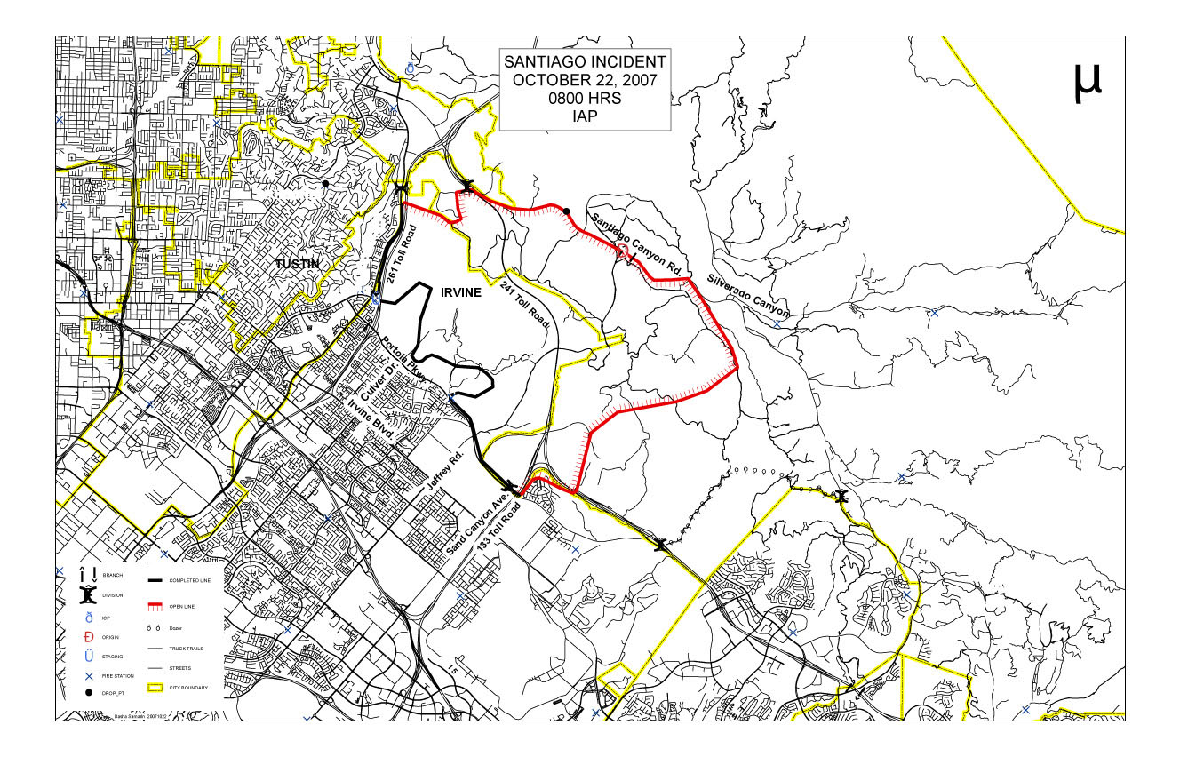
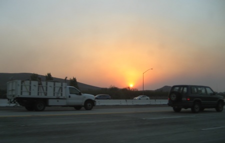
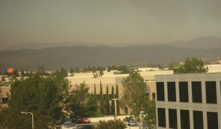
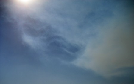
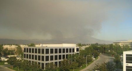
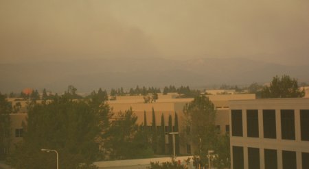
With the winds dying down, the smoke from the Santiago Fire clung loosely to the mountains most of the day. Unfortunately, smoke from the new fires down on Camp Pendleton drifted up the coast to take its place, bringing back the yellowish sunlight. Also, without the wind to clear them away, ashes left a thorough coating on anything outside. Work was somewhat calmer, with everyone (and their houses) finally accounted for. Power kept flickering throughout the afternoon, though. Between 4:30 and 5:00, something massive flared up, sending a new plume of smoke into the sky.

Orange Moon
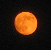
I ended up leaving the office after dark, giving me a chance to take some pictures of the orange moon (it was actually a bit past first quarter on Sunday, and it’s not quite full today*).

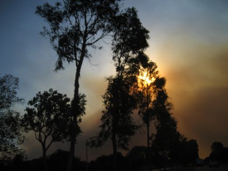
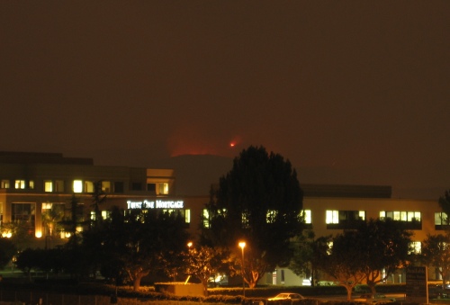
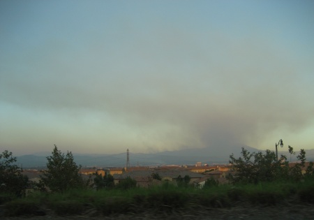
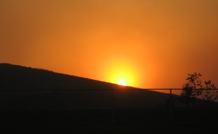
I also went looking for spots to take pictures of the red glow coming from the mountains. There’s a bridge near the office where I frequently take pictures of the hills, and I managed to find a spot where I could set up my mini-tripod and still have a view of the glow. There was one brighter patch which seemed to be changing shape, which I figured might actually be flames.

Mountain Glow

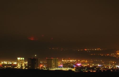
Afterward, I drove up to a cul-de-sac on Quail Hill which I’d discovered at lunch. I just parked my car at the end of the road, put the camera on top of it, and started trying shutter speeds.

Santiago Canyon Glow

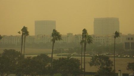
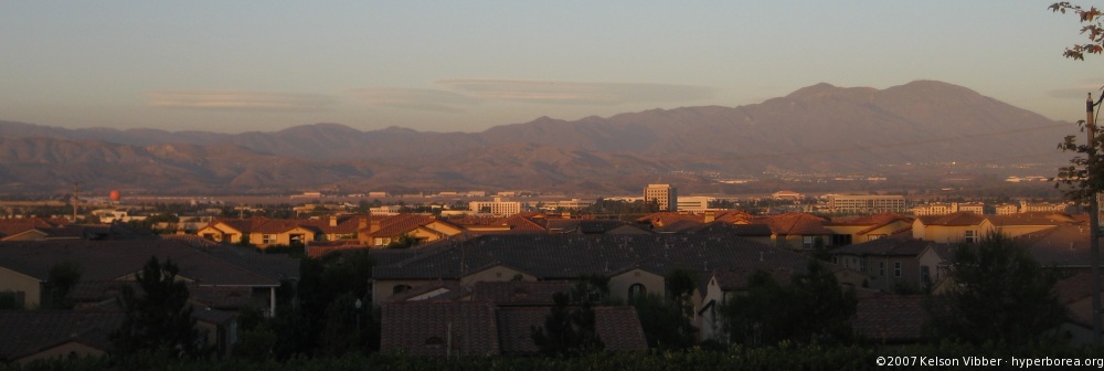
The vantage point gave me a better sense of geography. The Irvine Spectrum area lies in the foreground, with the 4 tall office buildings (the two in the middle are under construction) and the bright neon proclaiming the movie theater. The shopping center stretches off to the right. The empty area behind them consists of undeveloped land from the former El Toro Marine Base and the hills that burned earlier this week. The clusters of lights about 1/3 of the way up are, I think, Foothill Ranch. That places the glowing area in Santiago Canyon.

Even though some of the houses up on Quail Hill seemed to still be under construction, they had an efficient neighborhood watch going. I must have been there only 3 minutes before a van pulled up into a nearby space. A guy stepped out. No labels, no uniform. I said something along the lines of, “Hello, I’m taking pictures of the glow from Saddleback.” He said, “It’s still going, huh?” “Yeah.” I muttered something about exposure times, and he got back into his van and drove off.

*Strangely, I just discovered that my Nightmare Before Christmas calendar has the phases of the moon shifted… well, out of phase. It lists a new moon for Friday instead of a full moon. Everything else is consistent with this placement. Except reality.

Had a chance to run through all my Santiago Fire photos from the last few days with Katie and my parents, and they picked out a few favorites that I hadn’t already posted.

This first one was Monday morning around 10:30, as I drove into the region covered by the smoke plume.

Entering the smoke plume

Just a few minutes later, I had parked at work, deep within that plume. The sky was a hazy orange-brown, and the sun was bright orange, as you can see looking up at this tree.

Orange Sun & Tree

This next picture is yet another view of Monday’s sunset, seen from the 405 near Sand Canyon. This shows more variation in color, with a distinct cone of bright yellow surrounded by red, bounded by gray on the sides and fading to blue above.

Vulcan Sunset

Finally, here’s a view from the Quail Hill area on Tuesday just before sunset. This was taken from Knollcrest Park, roughly the same view as last month’s lenticular cloud photos. This is looking across the Saddleback Valley toward the Santa Ana Mountains. The smoke has cleared enough to see silhouettes, though the light has faded too much to see any more detail. The large plume is rising from Mt. Saddleback, the highest peak(s) in the range. The sun is very close to setting: the houses nearest the ridge are already in shadow, with the next row still in light.

Looking across the valley

Now that the wind and smoke have shifted, watching the progress of the fire has become a nervous office pastime. It’s far enough not to threaten us here, but from the windows along one side of the building, we can see the blackened hills through the haze. And we’ve got people who live in the areas being threatened. Every so often, a group will collect either looking out a conference room window, or checking current fire status online.

Charred Hills

Sunlight is almost normal, if a tad yellowish. I went over to the Spectrum for lunch (yesterday I just ate in the cafe downstairs), and everything looked like business as usual…with one key difference. People weren’t sitting outside if they could help it. Normally, on a day this hot, the tables outside the food court would be full, and small children would be running through the fountain. Today those tables were empty.

Wisps of smoke in the sky

I went up to the top floor of the parking structure to see what I could see, and to be honest, it wasn’t much. Even though the air was (relatively) clear where I was, it was still hazy off in the direction of the hills.

The wind mostly swept the pavement and sidewalks free of ash, but it’s collected on anything rougher—like a lawn. Whenever I cross a strip of grass, little puffs of dust rise around my feet. I had to clean my shoes when we got home.

Around 4:30 or so, the smoke lifted enough that the mountains were visible. After a few minutes, a thin column of smoke rose from behind the hills, with occasional bright flashes visible as flames flared up past the ridge.

Saddleback Smoke

It was getting dark by the time I picked Katie up from her office. On the way home, we could see the top of the ridge of hills silhouetted by a faint orange glow to the southeast.

The wind shifted during the day, and by mid-afternoon the sky near where I work was considerably clearer—even though the fire seemed to be getting closer.

Mt. Saddleback viewed from Tustin foothillsLenticular Line (large)Some geography: The Santa Ana Mountains run parallel to the coast, and form the northeast border between Orange County and Riverside County. Here are a couple of photos from older blog posts showing the hills and the mountains in the background (though from very different angles).

The fire “broke out”* in the foothills on the western side of the mountains. One side went straight over the line of hills and down toward the flatlands, threatening homes in northeastern Irvine last night. That was stopped, but it continued along the canyons to the end of this set of hills, and last I heard had reached the edges of neighboring Lake Forest.

I think the front may have gotten within 4–5 miles of where I work, though we couldn’t see anything but smoke in that direction until late in the afternoon. Every so often I’d wander over to a conference room that normally has a clear view. Off to the northeast, everything faded to brownish gray. It faded to the southwest as well, but at least I could see silhouettes of the hills in the opposite direction.

I did, however, watch ashes floating by horizontally, 4 stories up.

Toward mid-afternoon, the wind (and fire) shifted, moving the worst of the smoke plume away, and outlines became visible. I took this one around 5:30, and you can just see the (likely) charred and smoking hills. (Notice also the orange balloon off toward the left.)

Smoking Hills

With all the smoke in the air, the sunset colors were intense. As the sun sank, it was a brilliant orange.

Orange sunset

Magenta sun
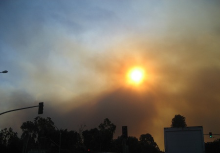
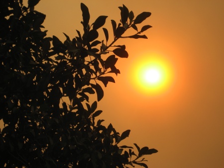
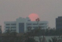
As it neared the horizon, dipping deeper into the layer of smoke, it turned almost purple, and was dim enough to look at directly. (Not that I stared—I’ve seen Pi after all!)

We got a break from the wind for several hours, which just ended minutes ago.

*Reports are that it was arson. What the hell is wrong with people who do this sort of thing? It’s not enough to set a bonfire, or even just burn down one structure—you have to burn down 15,000 acres of wilderness and possibly people’s homes?

Fire map as of 8:00 AMNo 3AM evacuations, though we’re several miles away from the danger zone anyway. The Santiago fire we spotted yesterday was stopped before it crossed into suburbia, but judging by the OCFA map it was a near thing. Now it’s burning southeast, into the hills and toward the canyons. Some of which are inhabited. (Yes, there is a rural Orange County.)

Downed TreeWe got some pictures of the fallen tree this morning. It managed to rip up a chunk of grass and displace a plastic divider, but it doesn’t seem to have damaged the walkway or stairs.

The winds are still going, which made the drive this morning… interesting. Leaves skittered across the road, swirling in dust devils. Some eucalyptus trees looked like they were bending at at least a 30° angle (and back again). My office turns out to be directly in the path of the smoke plume, which made for an odd view as I drove into it.

Passing into a smoke cloud

I’ve got some photos of a sepia sky, orange sun, and palm trees with all their leaves on one side, which I’ll try to post tonight, though it looks rather like the photo I posted during the October 2003 fires.

Smokey Spectrum

When I got to work, a few ashes were floating to the ground. I’m sure some of them managed to get into the car when I opened the door, which is rather annoying. There didn’t seem to be that many of them on the ground, until I noticed movement on the pavement. The ashes might look light-gray in the air, but they managed to blend in perfectly with the asphalt. That, and the wind seems to have blown most of them up against the curbs, where there’s a solid layer of ash.

The building, normally an off-white color, looked decidedly beige in the orange light. Everything looked faded. Well, almost everything. The iceplant around the parking lot edges looked greener than usual. It makes sense, since it’s normally bluish-green, and the orange-yellow lighting would cancel out the blue. Inside, the smell of smoke has permeated the building.

Update: Added photos.