And now for something completely different: Hawaiian snow. On our second-to-last day in Hawaii, we took a tour up to the summit of Mauna Kea, the highest mountain in the state at 13,796 feet. And even in early April, they still had snow at the summit.

Hawaiian Snow

We caught a somewhat hazy view of it from the west, in the Kohala area, but our best view of the mountain actually came the day after the tour, on our drive out to Akaka Falls. We’re probably due east of the mountain here:

Mauna Kea seen from the road to Akaka Falls

Continue reading

As long as I’m debunking myths about Southern California, check out this picture of the Los Angeles skyline:

LA Skyline Mountains by Nserrano CC-BY-SA-3.0 Wikimedia Commons

Granted, I doubt it looks like this very often (the mountains only get snow in winter, and you can only see them like this on a clear day). Source: public domain photo on Wikipedia.

Update January 2008: I see this post is getting a lot of attention with the recent snowstorms. I’ve posted a panorama photo of almost the entire mountain range covered in snow.

Update January 2016: Apparently the photo I originally had here was deleted from Wikipedia years ago because it wasn’t actually in the public domain. I’ve removed it and replaced it with a photo by Nserrano from the Wikimedia Commons, licensed under CC-BY_SA 3.0. It’s not quite the same view, but it’s just as impressive.

Update February 2019: We’re having another winter with lots of storms. I’ve posted some of my photos of the mountains from this month.

We didn’t get to see much of the Hilo side of the island. Our last day there, we checked out of the hotel and just started driving, figuring we’d just see how far we could get before turning back to make our flight. We did actually make it to Hilo itself—just in time to turn around. (It was a Sunday anyway, and supposedly there isn’t much open in Hilo on Sundays.)

When we first crossed through Waimea to Hamakua, we took a side trip north to the lookout for Waipio Valley. The valley itself is unreachable without 4-wheel drive (the road has a 25% grade), but the view from the lookout was incredible:

Waipio Lookout

Continue reading

It’s taking me longer than I thought to post all these Hawaii photos. North of Kona there are miles of old lava flows, the most recent of which were in 1801 (from Hualalai, the volcano above Kailua) and 1859 (from Mauna Loa, the second-higest peak on the island). Because the island is right in the middle of the trade winds, and has sizable mountains in the middle, the clouds all bunch up on the eastern side of the island, dropping several hundred inches of rain a year before stopping—rather abruptly—halfway across the island. The west side of the island, especially in North Kona and Kohala, gets closer to 10 inches of rain a year. That’s not far off, climate-wise, from Southern California. It also means that there’s not enough plants to break up a lava field in only 200 years, and large chunks of the coast look like this:

A‘a lava flow in Kohala (with coral graffiti!)
That’s not dirt, that’s rock! You may be wondering about the white bits. They’re a sort of temporary graffiti. All through this area, people have dragged out bits of coral to spell out messages ranging from “Hi Mom” and “Aloha Dolly” to “In Memory Of…” For some reason it’s almost universally good-natured. Katie’s got some interesting pictures. that we’ll be posting later.

Here’s a view of the coast itself. Continue reading

Found these at Sterling Art:

rum tankard goes here

There were four in the box; the last is on my desk at work scaring away dust bunnies. The company that makes them, Accoutrements, also has an Anne Bonny action figure, a sort of Dilbert-Playmobil collectible playset, and a cat-headed Buddha, among boatloads of other cool stuff. They don’t sell to the public (boo) but Sterling will ship (yay!).

Yarrrrr.

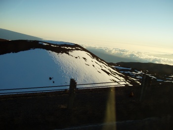
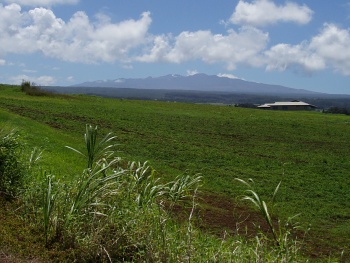
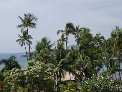
We spent a lot of time exploring the Kona coast, where towns manage to be both beach towns and mountain towns at the same time. It’s simplest to think of the island as one huge mountain (though there are really four mountains on the island, with a fifth, Kilauea, working its way up). The land just climbs up out of the sea and it’s easy to get several thousand feet up without going very far inland.

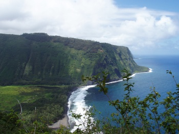
On our first full day, we just headed south to see what we could find. We randomly turned down Napo‘opo‘o Road, which while acceptable by rental-car standards, was a very winding road with lots of drop-offs. The road leads to Kealakekua Bay, a major kayak launching point, where we stopped and got a view across the bay.

View across Kealakekua Bay

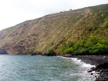
This shot quickly became my new desktop background on the laptop. Way off to the left (not visible in this photo) is the obelisk marking the spot where Captain Cook was killed by Hawaiians in 1779. Right by the road are the remains of the Hikiau Heiau (a heiau is a Hawaiian temple), where Cook read the burial rites for one of his sailors. Continue reading