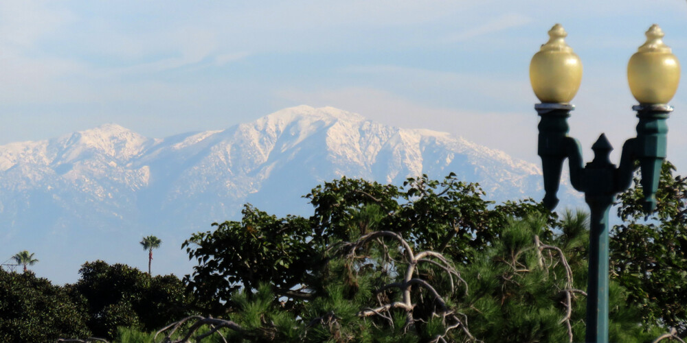
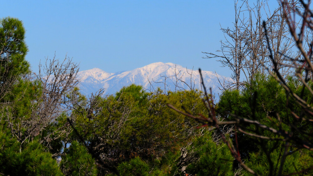
We actually got quite a bit of rain (for Southern California, anyway) in December, and the mountains have stayed cold enough that the snow has stuck around for a few weeks!

Here’s a view of the San Gabriels in mid-December, after a big storm.

Snow-covered mountains in the distance, with partly cloudy sky above and green trees and a lamp post in the foreground.

And here’s a comparable view a week into January.

Snow-covered mountains in the distance, with blue sky above and green pine trees in the foreground.

Nowhere near as impressive as, say, the entire range being covered in 2008, but that’s a rare occurrence even in non-drought years…and we’ve had mostly warmer and drier years since then.

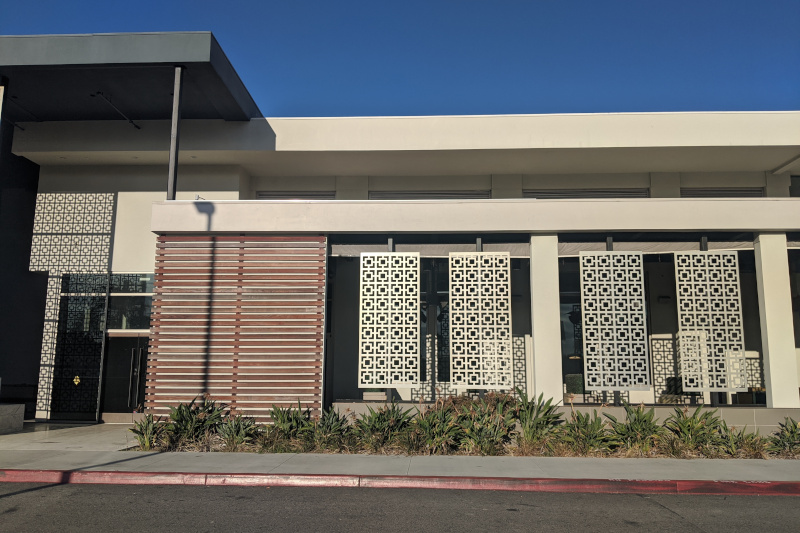
The outside of the former Great Maple restaurant at Del Amo Fashion Center. It opened with the new upscale wing of the mall, and closed suddenly about a year later. (Like, people showed up to work and the door was locked.) Nothing’s moved in since then, and of course nothing’s likely to move in for a while now.

The outside of a building with several tall screens of square patterns in front of it.

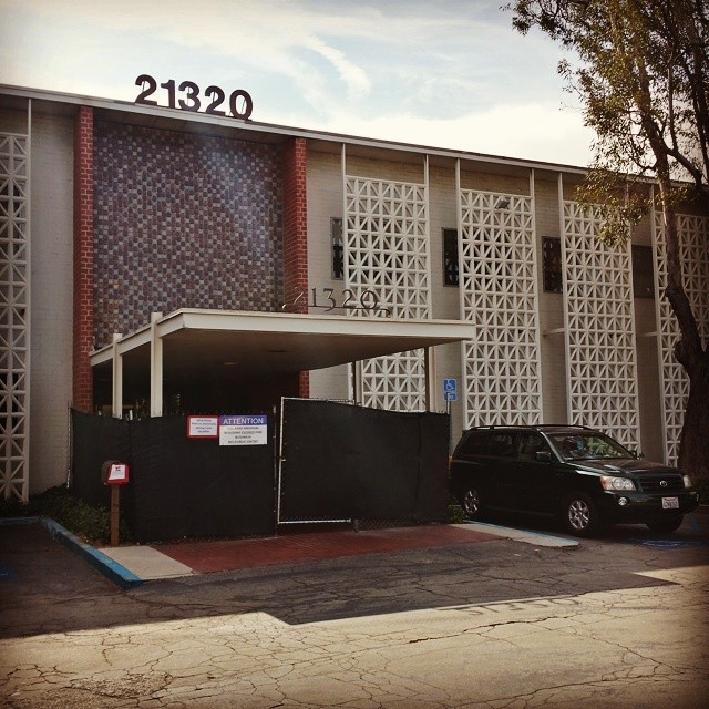
The facade reminds me a little of the facade on the old medical building that used to stand near the corner. It was demolished for the parking lot that came along with the mall expansion. And I have to wonder if someone was actually trying to keep a little bit of the old building’s character alive?

A two-story building with tiles and several vertical screens with square-and-diagonal patterns and an awning.

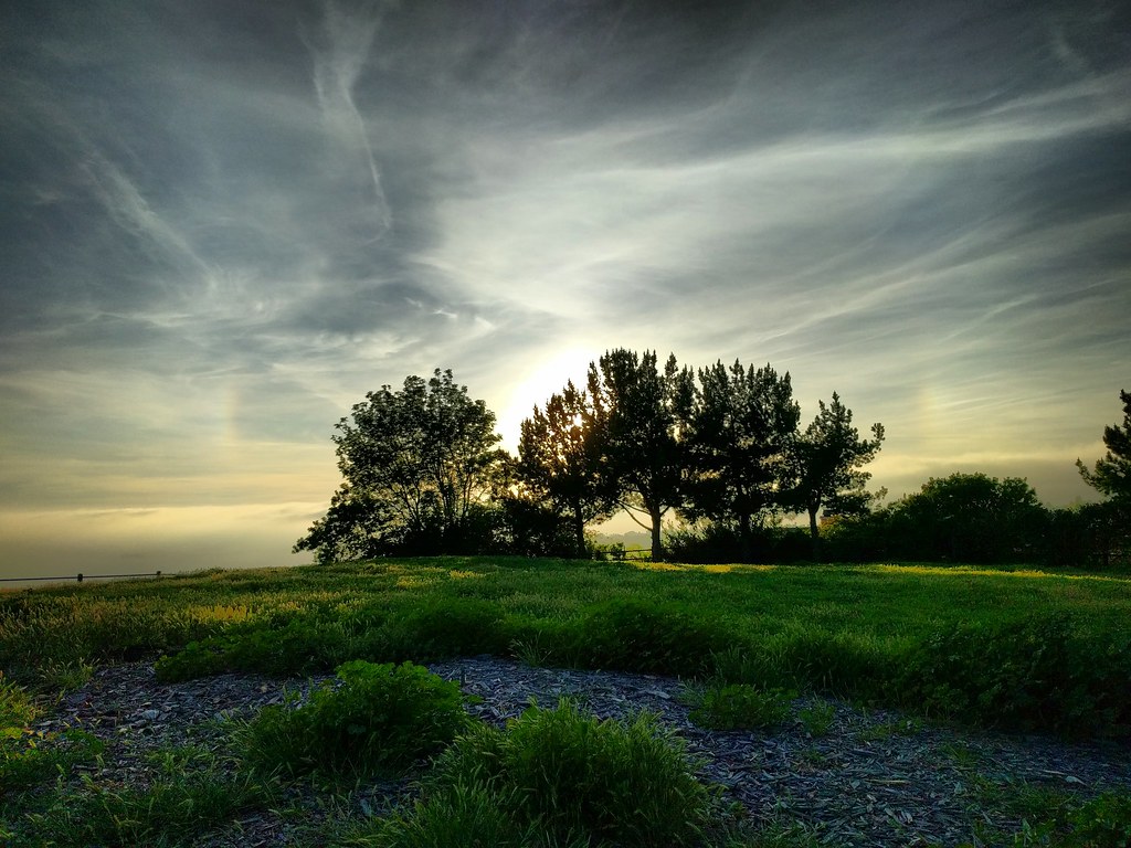
A whole lot of wispy clouds, plus fragments of a glowing circle above a green landscape. A grove of trees is silhouette against the sun.

After an afternoon of ice skating, I talked the family into making a quick trip up to Del Cerro Park in Palos Verdes. It takes a while to get there from home, but since we were already up in the hills for the ice rink, it was about five minutes. My original plan was just to walk out there myself, spend five minutes enjoying the view and taking pictures, then head back, but the five-year-old wanted to come along rather than wait in the car with mom.

Of course kids have their own pace, and while he wasn’t terribly interested in looking out at the ocean from a hilltop a few thousand feet up, he was fascinated by a lot of the other things along the way, which was how we ended up getting close to the hilltop at the right time for this view of the sky, sundogs, cirrus clouds, criss-crossing contrails, and silhouetted trees.

To be honest, he wasn’t terribly interested in that view either. At five, checking out foxtails and giant clover and gopher holes and fragments of concrete slabs (in a suspiciously flat and rectangular depression) and looking for the entrance to an incredibly long stairway and climbing and balancing on logs and looking for “the actual park part of the park” (i.e. the playground) are more appealing, and I barely had a chance for this moment to register.
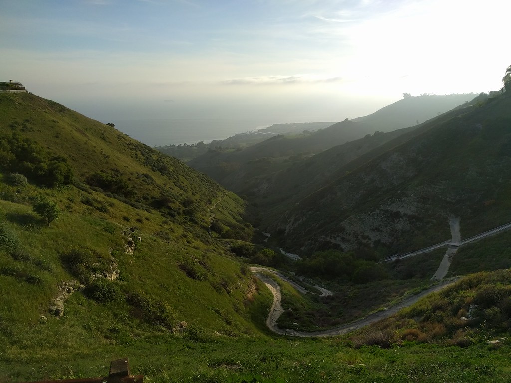
Looking down a green valley toward a hazy coastline. A path winds along the bottom, disappearing behind shadowed hills long before it reaches the sea.

We did eventually make it up to the top of the hill and the viewpoint. The ocean was covered in haze, completely blocking the view of Catalina Island and any chance of watching the patterns made by ocean currents and waves far below. That was fine. It wasn’t the highlight for either of us.
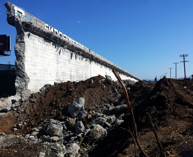
Since I work near the Century/Aviation intersection where Metro is planning to build a light rail station, I’ve been watching the demolition of the old bridge with some interest. The northern rise is pretty much obliterated now. The southern section is down to a single wall.

bridgewall

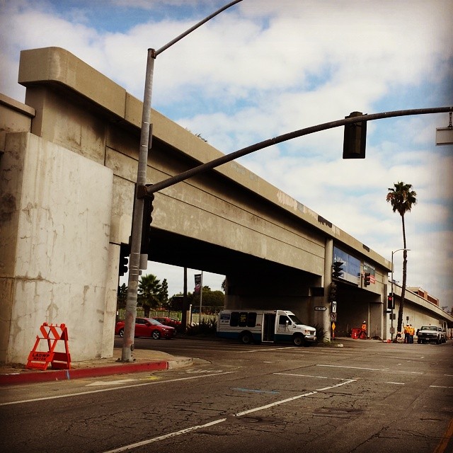
Here’s what it looked like three weeks ago, for comparison.

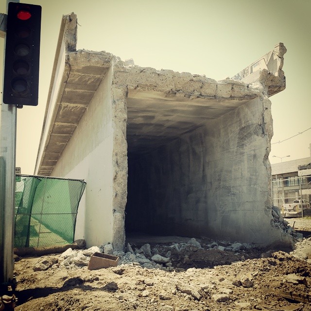
bridge-tunnel

Let’s take another look at that graffiti at the top of the wall:

bridge-graffitti

Not only do we have “Endor,” and “Death” (spelled funny) in a lettering style reminiscent of the Indiana Jones logo…I swear someone wrote “Ewok” off to the right. Or at least “EW[head]K,” which amounts to the same thing.

I was looking forward to checking out the aftermath of last weekend’s “Century Crunch” bridge demolition (see the before photo), but for various reasons I didn’t get a chance to really look at it until Thursday, when I finally felt up to walking down to the corner at lunch.

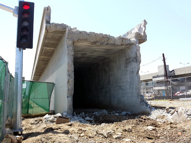
The most interesting part is the rise to the south of Century Blvd, where the remnants of the bridge come up to about 15 feet from the street. It’s fenced off, but of course when you’re walking by, the thin canvas they use doesn’t completely block your view. I was able to get my camera lens between two pieces of canvas to get the image here. It’s interesting that the ramp is hollow. I’m not sure what the normal design is, but I’d always thought that ramps like this were filled in with dirt, and that’s the impression I’d gotten from various projects I’ve seen in progress. Perhaps railroad bridges are different than freeway bridges? Or perhaps they emptied it out when they tore out the span?

It makes it look like the entrance to a tunnel, sloping down into the earth.
Continue reading

Century/Aviation Railroad Bridge

Next weekend, construction crews will tear out this old railroad bridge across Century Blvd near LAX to make way for a Metro station on the future Crenshaw Line. They’ve dubbed the road closure the Century Crunch. As of Thursday, they were already breaking down the parts of the bridge that don’t cross the street.

I actually drive under this bridge every day on my way to work — that’ll be a change. It’ll be interesting to watch progress on the Metro station as well. It’s been a while, but when I first started at this job, I had a much longer commute, and I would drive part way to the end of the Green Line and take the train to the nearest stop, Aviation Station, which will become the transfer point between the Green and Crenshaw Lines.

A two-story building with tiles and several vertical screens with square-and-diagonal patterns and an awning.

Another soon-to-be-demolished structure. This old medical building in Torrance has a lot more character than the bridge, but it’s being replaced by something less exciting, IMO: parking for the currently-expanding Del Amo Fashion Center. As if the mall isn’t big enough already. Sure, parts of it needed renovation, but the parts that needed it the most haven’t been touched by the current project.

Snow covered mountains lit up by the sun, with clouds above them.

Yesterday morning on my way to work, I looked over and saw the San Gabriel Mountains practically glowing with the morning light of the sun. A layer of cloud blocked the sun where I was, making the distant peaks look that much brighter. I stopped at a spot where I knew I’d have a good view of the mountain range.

It turned out to be a really interesting view, as you can see from the panorama below.

Wider view of the same snow covered mountains lit up by the sun, with clouds above them.
District Mountain Panorama

By lunchtime, the sky above was mostly clear, and clouds were bunched up against the mountains, completely blocking them. I was indoors most of the morning, but it seemed as if the cloud layer had just blown northward until it hit the mountains, then stopped.

Click on either image to go to its Flickr page.

Side Note: Stitching

Since Canon’s PhotoStitch no longer works on Snow Leopard, I’ve tried out Hugin again. It’s come a long way since I first tried to use it and spent hours just getting a panorama to break up spectacularly and went hunting for PhotoStitch on the disc that came with the camera! I can’t get it to automatically detect control points on Fedora, but it does a surprisingly good job even when I’ve only marked around 10 or so. The ability to customize things like which pieces appear in front of others, or which projection to use, has turned out to be useful as well.